Week
28:
Wed. Apr. 10, 2013—Day
190:
Destination: Seabreeze, Daytona (Mile 829.2) to St.
Augustine (Mile 778.2)
Departure: 0650 hrs. Arrival:
1440 hrs. Distance: 51 SM
Winds: E <3K, increased late am to 5-7K, then
<10K early afternoon
Weather: warm sun but cool breeze, threatening rain
clouds at times
 |
| Bridge of Lions |
Thankfully it was a quiet
& calm night + the current did not make any boats at anchor do any crazies
& somehow the yahoos around us did not bump us. We were out of bed before dawn & it was
actually pleasantly warm. We up anchored
without difficulty despite the 2 yahoos on either side; I admit I was anxious to
have the opportunity to blow the blow horn at them. Even at this early hour there was a parade of
7 sailing vessels travelling north along the Halifax River with a near 1K
current against us (travelling speed= 5.2 to 5.7K). Lately we have heard much talk of the
Marineland Marina, south of Matanzas Inlet at G89; $1.00 per ft., free laundry
(1 washer & 1 dryer). We experienced
good depths, varying from 10.3 to 18 ft. around the channel markers of Matanzas
Inlet, where we finally started to get a push from the current (6.2 to
6.8K). Two of the yahoo boats caught up
to us at the Crescent Beach Bridge (bascule) & of course wanted to pass;
one had the audacity to call the bridge tender when he was over a mile away
& asked that the bridge be held open for him; of course the answer was no
& he sounded shocked & upset! Daw!!!
The east side of the bridge was undergoing repairs. A falling tide was very evident as we were
still being pushed towards St. Augustine.
Graeme was not paying enough attention & with the south mooring
field close in sight he thought he could cut the corner between the red
markers, only to go hard aground in 4 ft. water north of R12 & far west of
G11. Rocks for brains came to mind. Unsuccessful in our attempts to get off after
5 mins. & with the tide still falling, he hailed Tow Boat US; we were
unsuccessful in contacting the local office but eventually were successful in
creeping towards the deeper water after about 20 mins., just as another boat
went aground to the east of us. Then it
was a rush but we made the 1430 hrs. opening of the Bridge of Lions. Our mooring ball assignment was in the north
or San Marco field as requested—SM4.
With ease we connected up to the mooring ball, then Ken from ‘Sail Away’
came over for a beer & chat. Now
late afternoon, we dinghied to the marina office to register ($20.00/
night). We met Dixie & Rex at the
dinghy landing dock. A welcomed shower
& a brief internet connection, enough to email home before it cut out. We walked to St. George St. & purchased
an ice cream; nothing like having dessert before supper. From our mooring ball we had a lovely view of
touristy St. Augustine under night lights.
A clear sunny afternoon led to a cool, clear, red hued evening sky &
cool, clear starry night.
 |
| Dixie & Rex (Wonderland) |
Thurs. Apr. 11, 2013—Day
191:
Destination: St. Augustine (Mile 778.2)
Winds: calm SE, increased early afternoon to 15-25K
& gusty & howling
Weather: threatening rain clouds, clearing to partly
sunny late am, then a partly cloudy evening
 |
| Off the main drag |
Fri. Apr. 12, 2013—Day
192:
Destination: St. Augustine (778.2)
Winds: SE 12-15K, decreased during am & clocked
to W 10-15K by sunset & < 5K & glass like at dark
Weather: warm, humid but decreased late pm, mostly
cloudy although the sun tried to break through, H= upper 70’sF & L= upper
60’sF
The strong howling
southerly winds + the wind & current driven chop decreased during the
night. It has become scary how well I
sleep through the night till near 0600 hrs. no matter what anchorage conditions
were like. ‘Whiski Mak’ departed by 0700
hrs. followed shortly thereafter by ‘Sail Away’ then ‘Twomorrows’; Larry texted
about 0930 hrs. saying they had anchored already at Pine Island (13.1 SM). To shore for an early shower, Graeme refill
ed2 water jerry cans, picked up the Davis light ordered yesterday while I took
the opportunity to do 1 load of laundry (1 wash= $1.50 + 1 dry= $1.50), which
would give me a great chance to do internet.
I just noticed today while I sat in the marina lounge for hours doing
emails & updating & adding pics to my blog, that there was a notice re
St. Augustine Cruisers Net each day at 0900 hrs. on VHF 72; cool! We had a combo of a late lunch & early
supper at Pizzalley (calzone halves); do you call that lunpper? And once again we lumbered along St. George
St. & the side streets closer to the harbour. There are more tourists in Spring than Fall
time for sure. Once back at the lounge
Graeme showered while I checked the weather forecast on the internet; nothing
seen for a week in contrast to what some cruisers were saying about horrendous
weather coming Tues. through Thurs. I
met Arlene & Al (Blue Heaven) who was with Pat & Tom when the tragic
incident took place & performed CPR on Pat.
I thanked her for all she & Al have done. The predicted rain & thunder of yesterday
appeared to veer just to the north & today’s predictions for possible rain
& thunderstorm thankfully did not materialize; the chop died down for most
of the day, especially by sunset. Lots
of dolphins seen gracefully swimming through the anchorage each day of our stay
here in St. Augustine. Clouds at sunset,
then a sudden burst of red sky through the clouds. A cloudy night with flat calm water.
 |
| Dolphins in North Mooring Field |
Sat. Apr. 13, 2012—Day
193:
Destination: St. Augustine (Mile 777.8) to Bells River,
Fernandina (Mile 716.5)
Departure: 0700 hrs. Arrival: 1630 hrs. Distance: 61.3 SM
Winds: NNW
to N 10-15K, eventually E 2-8K & calm at sunset
Weather: cloudy till mid am then clearer skies &
sun to the north

It was barely light when
we were out of bed. After an easy escape
from the mooring ball, we announced our departure to the marina & had a VHF
conversation with the Morrows as they were leaving Pine Island. Janet & David made it yesterday to
Jacksonville, but both they & the Morrows experienced 30K winds yesterday
afternoon. We departed on 2 hours into a
rising tide, so were opposed to the current for a short distance until we
rounded passed St. Augustine Inlet, then were pushed along the Tolomato River
at 6.6K as far as the Palm Valley Bridge where we slowly felt the current
opposing. The tides in this section are
now influenced by the St. John River; our speed gradually decreased to 5.7 down
to 5.0K the closer we got to the river.
In Palm Cut I started noticing the increase in spanish moss & the
more vibrant & alive shade of green to the trees & shrubs, another sure
sign of Spring. There was a parade of
boats, particularly trawlers, northbound as there was a trawler rendezvous (84)
in Fernandina starting tomorrow X 1 week; no marina space available, not that
we wanted one. Approaching the McCormack
Bridge (known for it’s fast rushing current & eddies), a large motor vessel
(Chinta Manis) continued to pass after I specifically said negative to his
request, then he refused to respond to me; SETHING! The St. John River crossing was benign &
we never got a push on the north side of Sister Creek Bridge (bascule-Mile 739.2) as expected; in fact we
fought the current the whole friggin way (<5K). Was water flowing here to the St. John River
or in from the Nassau Sound? Also, 90%
of the day the clocking wind was on our nose. The route was multi directional
as the ICW wound through the South Amelia & Amelia Rivers’ shallows. Attention was necessary at R50 & G49
(can) of the Sawpit Creek & also Nassau Sound R46B, R46A & R46. The only tremendous push was after Amelia
City about G23, G21, & G19, past Crane Island & the Kingsley Creek RR
Bridge (Mile 720.7). It was a falling
tide, therefore here the water must run along the Amelia River to Cumberland
Sound & St. Mary Inlet. I drove the
majority of the day & followed the magenta line, yet I saw 5.1 ft. in the
Amelia River, south of Kingsley Creek; SCARY!
It is very deceiving when the tide is falling yet not low enough to
expose the numerous mud flats of this area & the circuitous ribbon of ICW
water. It was already 1600 hrs. when we
arrived at Fernandina. We had hoped to
make it to Cumberland Island for the night, but we would have been fighting a
strong current in Cumberland Sound.
Instead we anchored in the Bells River; 12 ft. water & 100 ft.
chain. Lynn & Larry anchored at
Cumberland Island but they had started this am from Pine Island (-13 SM). They will move on tomorrow, but this is
likely my last trip, so weather permitting we will stop for a day there
tomorrow. A cloudless evening sky, a
spectacular setting sun & ditto for the red sky after sunset. Tonight we had a sliver moon high in the
clear sky with the many stars.
Sun. Apr. 14, 2013—Day
194:
Destination: Bells River, Fernandina (Mile 716.5) to
Lanier Island, St. Simon Island (Mile 677.2), Georgia
Departure: 0755 hrs. Arrival:
1440 hrs.
Distance: 39 SM
Winds: NNE to NE 5K, increased to 13-5K & E by
evening & gusting 20-25K
Weather: cloudy, threatening rain, damp & cool in
am & rainy & thunderstorm & tornado warnings early afternoon
onwards
 |
| Sub Degausing in Kings Bay |
Mon. Apr. 15,
2013—Day 195:
Destination: Lanier Island, St. Simon Island (Mile 677.2)
Winds: NNE to NE <10K
Weather: fog+++, mix of cloud & sun with
decreasing humidity by afternoon
Addendum to add to last
evening’s blog: rain prevented us from
getting off the boat yesterday afternoon.
In fact in the late evening hours the rain became heavier & at about
2030 hrs. the southerly winds intensified & became very gusty, at least
25-30K. At 2015 hrs. we turned the VHF
on & thunderstorms with heavy rain & hail & a tornado warning was
issued for Glynn County & the surrounding area, but especially Fernandina
to St. Augustine, just south of our location; Marineland was mentioned
imparticular. Between 2100 & 2230
hrs. we experienced horrendous gusting & howling winds, heeling us
over. I hope our 100 ft of chain &
anchor hold us! Afterwards the winds
became calm, as if a switch was flicked on.
We learnt this am that boats tied up at the marina also heeled heavily
into the dock & winds were reported at 65 mph.
 |
| St. Simon Lighthouse |
Tues. Apr. 16, 2013—Day
196:
Destination: St. Simon Island (Mile 677.2) to Wahoo River
(Mile 630)
Departure: 0820 hrs. Arrival: 1620 hrs. Distance: 47.2 SM
Winds: NE 8K, increased my mid am to 15-20K &
18-20K most of the afternoon
Weather: light fog then mostly sunny with few clouds
but cool breeze
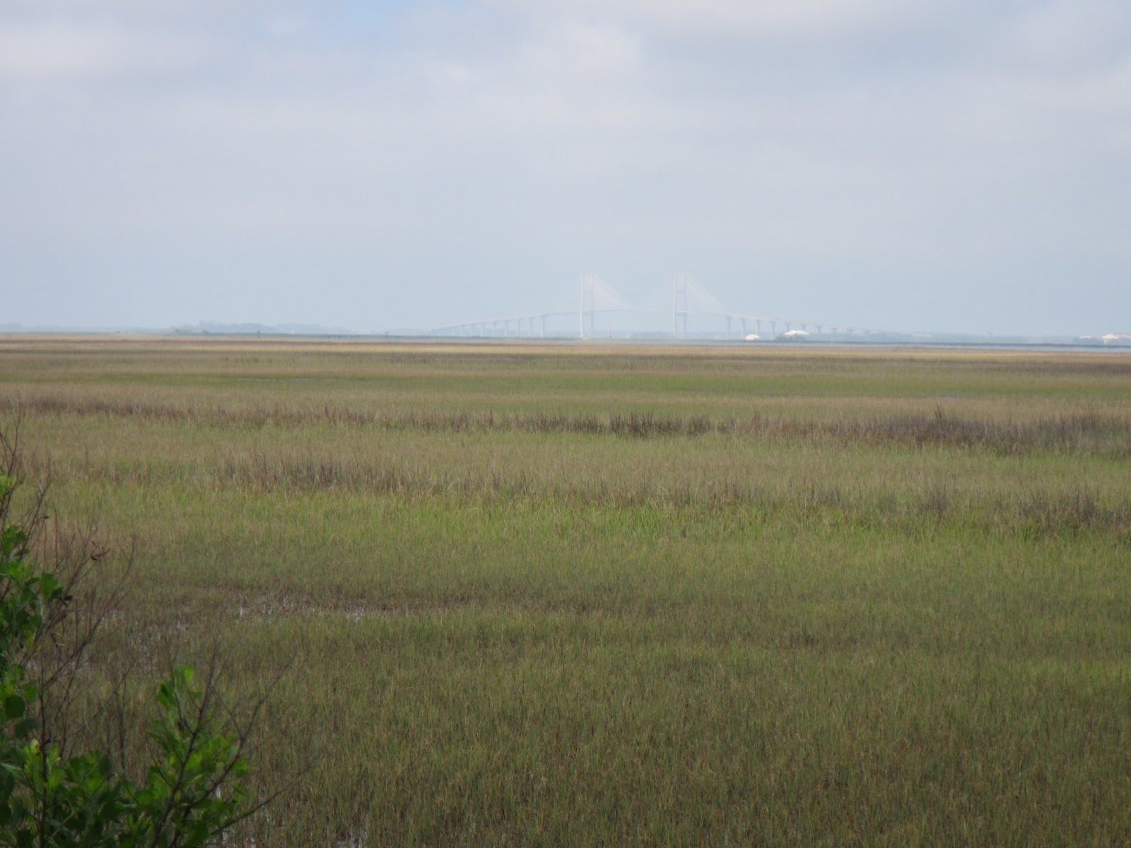 |
| Sidney Lanier Bridge to Brunswick in the background |
No comments:
Post a Comment