Wednesday, April 24, 2013

Week 30: Apr. 24-30, 2013 (Day 204- 210)


Week 30:  

Wed. Apr. 24, 2013—Day 204:
Destination:  Church Creek (Mile 488.2) to Charleston Maritime Center (Mile 464.1)
Departure:  0705 hrs.                             Arrival:  1115 hrs.                                   Distance:  42.1 SM
Winds:  calm, NE shifting to S to SSW by evening & calm at night
Weather:  low lying fog over the water & marsh grasses, clear & sunny, thick fog then clear & sunny once again

Sunrise in Church Creek
Mist over the water 
Mist hung over the water & saltwater marsh grasses at sunrise; most picturesque!  The water surface was calm last night & a mirror this morning.  Moisture+++ clung to the windows; at departure time we had to roll the side & front windows up in order to see.  Also a very picturesque view until 1-2 mi. from Church Creek; the fog became more intense, thick+++ for a few miles.   Graeme had to maneuver the boat via the chartplotter alone under reduced speed.  It then quickly thinned & the brilliant sunshine & cloudless sky was upon us.  We left on a rising tide, against current & at R20 the tide reversed & now we were with the current.  Our timing was good as maximum tide at Stono River & Elliott Cut was at 0810 hrs. & we entered the cut at 0941 hrs. on a falling tide, which runs to Charleston Harbor, therefore we ran the cut with the current at a speed of 8.8K & through at 0944 hrs. (3 minutes!).  The Wappoo Creek Bridge (bascule) opening was at 1000 hrs.  Against current we ran the Ashley River, turning behind a large freighter up the Cooper River in the shipping lane.  At the appropriate time & after passing the entrance a short distance, Graeme turned into the Charleston Maritime Center Marina, having to be very careful to avoid clipping the bowsprit of a Swedish tallship, hanging ½ way into the entrance channel.  Graeme maneuvered well into the slip & 2 dock hands were available to catch our midship & bow lines.  Lunch, registered at the marina office & paid for 2 nights & I washed my hair.  We now had ½ a day to tour, then a full day tomorrow.  Although the S to SSW breeze increased, the sun shone & it was warm enough to walk around downtown in shorts.  We started at the Aquarium & Fort Sumter Museum for their hours of operation (a national park, so Graeme can use his lifetime pass to tour for free, except for the ferry ride to Fort Sumter), down Calhoun to King St., to the City Market & an early supper (1730 hrs.--yuks!) Noisy Oyster on E. Bay St. before walking back to the marina & boat.  Clouds started to roll in,  but some orangey sky after sunset.  Non official full moon visible, few stars but difficult to see with all the city lights.
Ravenal Bridge

Thurs. Apr. 25, 2013—Day 205:

Destination:  Charleston (Mile 464.1)

Winds:  very light westerlies till 1615 hrs., then NNW with thunderstorm 15K X45 min. then calm by further shifting to NE

Weather:  pleasant sunny day till 1500 hrs., then black skies from the west with rain then lightning & thunder & heavy rains about 1615 hrs., then clouds & on & off rain


One of my many photos of wrought iron gates
Splendid Gardens & Huge Balconies


Graeme & I toured most of the day separately; it was good to have the chance to have our own space.  My decision was to tour by bike or walk; I certainly needed the  exercise to start shedding some added weight.  I sure put in many miles over a total of 4-1/2 walking hours, in & out of main streets, side streets & lanes in the following areas of historic Charleston: Ansonborough (Laurens & Anson St.), Downtown (Cumberland, State, Church, Meeting, Queen St.), South of Broad (East Bay, Church, Meeting, Longitude Lane, Water, Atlantic, South Battery St.)  & Harleston Village (Queen, Broad, Colonial Lake, Moultrie Park, Barre, Beaufain, Market St.).  I saw many designs of infamous Charleston wrought iron doors, gates & fences & patterns adorned to walls.  Typical Charleston homes were of the colonial & Victorian style with street doors, tall 2 storey narrow homes with long balconies, some on 1 level & others on 2 levels facing south or west to catch the prevailing winds on hot summer days, some single homes but many attached to one another yet separate buildings & different in design & architecture.  Some homes had large yards & gardens, but many had small manicured, sculpted yards & all with very rich, new & alive green colours.  Colourful flower boxes adorned homes & even lanes.  Colourful flowers were seen in yards & plantars, as well as flowering trees & shrubs; magnolias were in bud, but I did saw one full blossom.  Charleston is a place one must visit to take in & appreciate all the sights.  Everyone falls in love with Charleston; I have BIG time.   At noon I attended the St. Philip’s Church Tea Room Luncheon (Apr. 22-26, 2013 at 1130-1400 hrs.)—superb as always.  Graeme & I met at the south end of City Market & walked the market from west to east when we saw black rain clouds approaching.  A drink at Molly Darcy on East Bay St. & the 1st rain hit.  We donned our raincoats when the rain subsided & walked to Harris Teeter (ground beef, butter & 2 apples).  Back at the marina we confirmed tomorrow morning’s tides & our departure time.  The 2nd wave of black clouds & very heavy rains with lightning & thunder arrived with about 15K NNW winds X 45 min., then calm.  On & off rainy periods followed.  A cloudy evening & partially cloudy night; few stars seen but not the official full moon.

Outside Seating at St. Philip's Tea Luncheon

Seagrass Basket


 There are so many more photos I have & would like to add to my blog, but there so little space to do so! 

Fri. Apr. 26, 2013—Day 206:

Destination:  Charleston (Mile 464.1) to Minim Creek (Mile 415.4)

Departure:  0810 hrs.                             Arrival:  1720 hrs.                                      Distance:  48.7 SM

Winds:  NE 8K, quickly increased to 15-20K with 25K gusts, consistent 20-25K & E+/-15K at evening
Weather:  cloudy & semi cool start, then quickly wall to wall sun & very blue sky

Low Tide Nearing McCellanville
It was stand in line for a shower this morning even at 0700 hrs.  Jeff assisted us off the dock with ease at fairly slack high tide (high tide= 0853 hrs.).  Less than one hour to high tide we pushed against tide the 1.9 mi. to Ben Sawyer (bascule) Bridge; once vehicular traffic was cleared we made a requested opening & passed through at 0918 hrs.  Oh, did I mention that the wind was on our nose?  All day!!!  And to boot the winds increased significantly + against a falling tide, at full moon time, which means higher highs & more importantly lower lows.   No problems were encountered with the depths through Isle of Palm & Awendaw Creek area, BUT approaching McCellanville at 1400 hrs. (6 hrs. post Charleston), 1-1/2 hrs. before max. low tide, we experienced very, very low water of 5’5” to 6 ft. at G39 & G37 to G35A & 4’8” to 5 ft. at G35A to G35; we didn’t touch but how can that be when we draw 4’11” empty!  I drove a lot today, but glad that Graeme did that stretch as I would have freaked.  The seesaw effect with our speed was apparent today depending on the direction of the water flow from it’s source on a falling tide; very infrequently we were on the “saw” side & did not have any push + a more or less 20K wind also against us & some whitecapped chop.  The wind & current were so strong that many of the fish traps had a hard time to stay above water.  We saw dolphins early in the morning in Charleston & maybe one alligator swimming in the water of the Cape Romain Wildlife National Reserve, some birds diving for fish but that was all.  So all in all it was a nerve racking & frustrating day.  We anchored on a rising low tide in the east Minim Creek in 8 ft. water with 80 ft. of chain with still a brilliant sun shining & blue sky & a cool +/-15K east wind, which continued to lie down at sunset.  Four boats here tonight.  A cloud suddenly appeared & across the setting sun.  A pitch dark night, stars & a later rising fullish moon.  

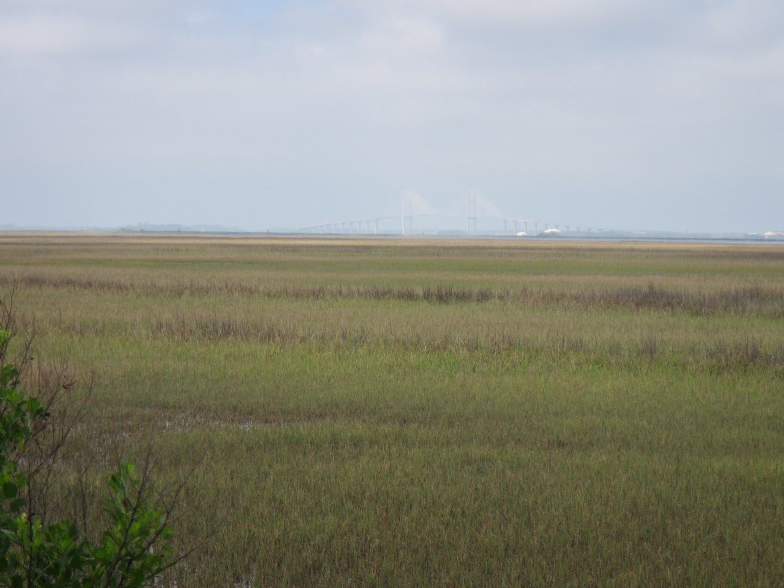
Sat. Apr. 27, 2013—Day 207:
Destination:  Minim Creek (Mile 415.4) to Osprey Marina, Myrtle Beach (Mile 373.5)
Departure:  0705 hrs.                                  Arrival:  1305 hrs.                                 Distance:  41.9 SM
Winds:  mostly ENE to E 8-15K
Weather:  light cloud cover at the start, soon sun & cloud mix, then full sun & blue skies early afternoon before a line of clouds rolled in from the west

Barge & Tug in the Waccamaw River
Turtles in Osprey Marina & throughtout the Waccamaw 

Three of the four boats left one after the other on this calm morning.  We were pushed with the tidal current.  A barge & tug passed the entrance of the creek just in front of all of us, taking up a majority of the width of the Esterville Minim Creek Canal.  We passed Georgetown at 0840 hrs., still with the current.   In fact, the further north we travelled today, the later high tide was; this meant we were with the current all day & were able to maintain a boat speed of 6.2-6.7K with low engine RPM’s, & thus made good travelling time.  We followed the barge & tug into the Waccamaw River (Mile 403).  This river is deeply wooded to it’s banks & especially alive with new growth & vibrant greens in the Spring, one of the most scenic part of all of the ICW with moss-draped cypress trees, wildflowers & greenery growing in cypress stumps, brown coffee coloured water & numerous great anchorages filled with birds & fish.  Several boats made a fuel stop at Osprey Marina, our destination for the night, so we had to slow up with our arrival time & even tied up at the transient dock till the fuel dock was clear & our turn in line.  Once our diesel tank was topped with a whopping 9-1/2 gals. compared to 300 gals. for other boats we moved & tied in our assigned slip (C10).  It was early to stop for the day, but this was one of Graeme’s favourite places; it boasts superb hospitality, great facilities, very friendly & helpful, the best welcome package of all marinas & inexpensive.  So often going south you hit certain anchorages & marinas & different favourites coming north.  If I wasn’t so anxious to get home we would stay in a few anchorages off this wonderful river.  Big mileage & some caution shallow areas tomorrow + rain in the forecast, but we are hoping to reunite with Lynn & Larry.  Clouds at sunset as well as during the night.


Sun. Apr. 28, 2013—Day 208:
Destination:  Osprey Marina, Myrtle Beach, S.C. (Mile 373.5) to St. James Marina, Southport, N.C. (Mile 315)
Departure:  700 hrs.                                       Arrival:  1600 hrs.                                Distance: 58.5 SM
Winds:  NE to E 8K steadily increasing to 10-15K to 18-22K
Weather:  light cloud with few sunny breaks, cool breeze

Cable Car over ICW at Myrtle Beach Golf Course
Little River Swing Bridge
Only in the South!
A great shower with a powerful shower head last night & again this early am.  It was calm as usual in this protected marina, so we were off the dock easily by ourselves before the marina opened at 0800 hrs.  A few boats were already in the ICW when we departed.  We carried the current in our favour at about 6.5K until Grand Dunes where the current reversed.  We caught the Socastee Swing Bridge (Mile 370.9) opening at 0730 hrs. & the Barefoot Landing Swing Bridge (Mile 354.3) opening at 1000 hrs. Through the Rockpile  (Mile 353 to 349) at 1015 hrs. we saw depths of 13-15 ft.  And finally, we passed the Little River Swing Bridge at 1109 hrs.  We left South Caroline shortly after Calabash River & Little River Inlet at 1155 hrs. & entered North Carolina against current.  Passing through Shallotte Inlet at 1340 hrs. was no problem with depths, but our speed dropped from 7.7K to 3.6K.  Yes, of course the wind was on our nose & a hindrance when it reached strengths of 18-22K & one travels in an easterly direction from northern South Carolina coastline into North Carolina as well.  There was a lot of Sunday recreational waterway traffic ie powerboats+++ & seadoos, almost as bad as Florida on a weekend, just as disrespectful of other boats by not announcing themselves when passing & especially disrespectful of the environment with their wake; the only difference was the boats were just not as big as in Florida.  I tried to read sitting on the combing & lying on the deck but it was just too damn cold.  And finally the last challenge of the day was through Lockwoods Folly at 1510 hrs. 1-1/2 hrs. before low tide; lots of chatter on the VHF with reports coming as boats passed.  I stayed to the green side of midline, on the magenta line of the chartplotter & saw 7.4 to 8.8 ft.  As like the other inlets, there was turbulence you needed to steer with.  I seemed to be driving through all the caution areas today.  Mike & Larry assisted to tying us up at dockside (D10), but Graeme did another good boat maneuvering.  Then hellos, a drink, snacks & enjoyable conversation on ‘Twomorrows’.  Last minute decision was to throw in a load of laundry on while we had dinner at the restaurant; 1 washer & 1 dryer $1.00 each.   A clouded evening with rain threatening & a clouded night sky.

Mon. Apr. 29, 2013-- Day 209:
Destination:  St. James Marina (Mile 315) to Banks Channel, Wrightsville (Mile 283.2)
Departure:  0920 hrs.                                 Arrival:  1400 hrs.                                    Distance:  31.8 SM
Winds:  NE <10K, S <10K only in evening
Weather:  heavy cloud then rain+++ till noon, few sunny periods mid afternoon & back to rain

When we could see this Fishing Boat & free food for Pelicans
Carolina Beach
Due to heavy rains this am the decision was whether to part or not & also in keeping with the most favourable passage method of the Cape Fear River; Skipper Bog suggests leaving Southport 1 hr. before high tide is most advantageous & we were 1 hr. from Southport.  We listened to NOAA, conferred with Lynn & her weather sources & let one wave of heavy rain pass before making our final decision.  There was nothing to do here, nothing close by, Lynn & Larry were going with friends from Wilmington for the day & the rain had let up; we were going.  We were assisted off the dock by marina staff & eased out of the slip.  Soon afterwards in the ICW black clouds to the NW were very evident, heavy rains commenced again & much to our dismay there was lightning & thunder; do we continue or turn back???  We set up a fan to circulate air on the front dodger window to keep it somewhat clear.  At 1030 hrs. we arrived at Southport & entered the Cape Fear River.  It was raining so heavily at this point we could only see approximately ¼ mile ahead; it was just like thick fog.  Suddenly we saw stationary tugs with boom-like apparatus attached on starboard then on port, but at first glance were they on the move or not?  We picked up the shipping channel, announced our presence to concerned traffic & picked our way from one channel marker to the other with heavy assistance from the chartplotter.  Our boat speed was 8K with the flood tide & fortunately the sea state was calm.  Just after a picking up the sighting of a long dock to port (? ferry dock) we saw a moving vessel coming towards us & thought it was a tug; we hailed the “tug” & the ferry boat announced her presence; we apologized for our error.  Shortly afterwards the rain eased & stopped & the visibility improved & we continued picking our way maintaining good speed.  Phew!  No ships or freight traffic were encountered, which was most unusual for this large commercial channel; we only saw a small fishing boat with a large trailing & following of pelicans for free food.  We left the shipping channel at G33 & re-established ourselves on the ICW to Snows Cut near noontime; we were just off high tide, so had good depths (16 ft.) through this section.  The bridge was under repairs but a non-issue for our 54 ft. mast.  We turned to port in the ICW that runs parallel to the Carolina Beach Inlet & a notorious shoaling spot, but not a problem just 1 hr. off high tide.  Here the current changed & our speed dropped until we were nearing & feeling the positive sucking effects of Masonboro Inlet.  Some very dark, very ugly clouds to the east out to sea, some clearing & blue sky to the NE as well as south.  The light NE winds today were on our nose; no south winds as predicted until evening time.  We left the ICW at G129 & took the deeper Shinn Creek passage to the Banks Channel anchorage (10 ft. water & 90 ft. chain).  Even though it was stressful traversing Cape Fear River with restricted visibility, our timing was exact from marina against current on a rising tide, through Southport & up the Cape Fear River with the current still on a rising tide & through Snows Cut with the current 1 hr. after high tide, thus on a high falling tide.  An early arrival time, but time to rest the frazzled nerves. Only 7 boats tonight at this usually popular anchorage.  A few sunny periods mid afternoon before more clouds & fine rain settled in over the late afternoon, evening & night.

Tues. Apr. 30, 2013—Day 210:
Destination:  Wrightsville Beach (Mile 283.2) to Mile Hammock (Mile 244.5)
Departure:  0715 hrs.                                Arrival:  1450 hrs.                                Distance:  38.7 SM
Winds:  NNE to NE 8K, increased to 10-15K, then E to N & calm at sunset
Weather:  clouds with few bright periods & times when the sun broke through the clouds

Clams or Oysters?

Mile Hammock
The last day of another month (#7).  Weather-wise, a 2nd disappointingly cool month with mostly northerly winds, although most days were sunny ones; yesterday especially & today were the two most cloudiest days so far on the whole trip.  We calculated yesterday that it would be best to catch the 0800 hrs. opening of Wrightsville Beach Bridge (bascule) & then hourly openings on the other 2 following bridges so as to play the tides most effectively; that would gives us an hour into a rising tide when we upanchored & 1-2 hrs. after high tide when we would be transiting the New River, a shallow problem area.  But we did temporarily went aground ever so gently on Motts Channel at G25; there must be a hump extending from the docks, so one must absolutely go directly on a line at G25 marker.  After the Wrightsville Beach Bridge at 0800 hrs. we took the hour to do the 5 mile distance to Figure Eight Swing Bridge & thought 2 to 2-1/2 hrs. to Surf City Swing Bridge like when we were southbound in the Fall, but we were too late for the 1100 hrs. opening & passed through at 1200 hrs., which would make us into the 2 hrs. post high tide time frame for New River.  The winds were directly on our nose, not too much boat traffic & the same Mile action with boat speed with the many small & larger inlets from the ocean.  There were fewer & fewer palm trees the last few days coming north, but an increasing number of new osprey nests on the channel markers than further south.  As I’ve been doing the majority of the driving the last few days, I’ve been able to see the lay of the land & put visual pictures to places I’ve read in the various cruising guidebooks.  We arrived at the New River Inlet at 1420 hrs. & saw depths of 13-15 ft. except 1 spot at 72A (10 ft.).  We were the 3rd boat in & anchored in 12 ft. water with 80 ft. of chain, but by sunset there were a total of 13 boats.  When upanchoring this am, I noticed the bowroller was not as it should be (spindle had come unscrewed); Graeme did some repair while underway & completed the job after anchoring.  About 1715 hrs. a military dinghy came over to a few of us boats & asked with we would reanchor slightly more eastward as they were conducting diving maneuvers this evening.  Also we were warned by a boat that we travelled through all the bridges today that the Onslow Bridge was closed down for a couple of hours for repairs.  This is the bridge we will need to open within 3.4 mi. tomorrow morning.  Graeme hailed them on the VHF & the bridge was now operational.  We had quite a display of military maneuvers after sunset, between divers in the water & repeated twin blade & regular helicopter landings & take-offs; very noisy way after dark till 2200 hrs..  Clouds were heavy at sunset but somehow the sun seemed to have found a small break in the cloud & a brilliant red shone just over the land & through the trees.  A 30 sec. rain shower & a dark night.


Saturday, April 20, 2013

Week 29: Apr. 17-23, 2013 (Day 197-203)


Week 29:

Wed. Apr. 17, 2013—Day 197:
Destination:  Wahoo River (Mile 630) to Turner Creek, Savannah (Mile 585.5)
Departure:  0755 hrs.                               Arrival:  1540 hrs.                            Distance:  44.5 SM
Winds:  NE 8-17K depending on proximity to Sounds & Inlets, calm at sunset
Weather:  warm sun but cool breeze with clouds to west & south, clouds at sunset

All the Sounds & Inlets that affect our Tidal Currents
A calm & warm night.  A warm bright sun most of the day but the breeze was cool.  In Johnson Creek we were warned to pass close to markers G131A & G131 for best depths.  Large pods of dolphins were seen in Johnson Creek & especially North Newport River; in fact one leaped completely out of the water twice or it was 2 separate leaping dolphins!  NE winds increased to 15K in St. Catherines Sound & we were motoring against an incoming (flood) tide from the inlet with of course the wind on our nose (speed= +/- 4.5K).  We were able to use a little jenny when we turned down in the Sound away from the Inlet toward Bear River, with a slight reprieve of the opposing current through Bear River until we exited Florida Passage into the Ogeechee River.  Here once again the wind was on our nose & we were now experiencing a flood tide from the Ossabow Sound & Inlet (speed= 4.8 with 12K wind).  We hit Hell Gate passage at 1235 hrs., about 2 hrs. before high tide; mostly 13 ft. except 11.3 ft. crossing over the shoal & 15 ft. exiting to R36.  We were now off the wind as we turned down the Vernon River & set some jenny (speed= 7.0K), then furled the sail as we turned into Burnside Creek.  This was another serpentine route, now through marsh grasses on one side & residential, big expensive homes onshore.  The Skidaway Narrows fixed Bridge was still under construction but the bascule bridge opened quickly on request.  The tide was still rising as we left the ICW to cross Wilmington River into Turner Creek; good depths of 12-15 ft.  Anchoring was a bit interesting as the wind was 90 degrees to the incoming (flood) tide.  Clouds arrived right at sunset.  A few pale & dark pink streaks in the clouded sky.  ¼ moon was visible through the light night cloud.

A Wahoo River, Georgia Sunset
Thurs. Apr. 18, 2013—Day 198:
Destination:  Turner Creek, Savannah (Mile 585.5)
Winds:  E 5-10K
Weather:  mostly sunny & warm once morning clouds moved off, few clouds in the afternoon

In famous Savannah Squares in Spring
A warm night & also I must mention that for several weeks now we have experienced condensation & moisture at night, especially on deck & the enclosure & heavy in the morning; the enclosure windows required wiping before setting off in the morning.  We dinghied & tied up to Hogan’s Marina before they open at 0800 hrs.  We walked across from the Publix on Johnny Mercer, were attacked by gnats & caught the CAT #10 bus at 0830 hrs. (seniors rate--65 yrs.= $0.75 each).  The Cat route & schedule for some runs must have changed on Apr. 8, 2013 according to a posted sign, but that did not affect us.  The morning ride in was most interesting as the friendly riders usually African American, spoke easily & freely with us, offering suggestions & a few on entering the bus loudly bid “good morning all!”  The 1 hour bus ride brought us to downtown Savannah at the corner of Martin Luther King & Broughton.  Graeme & I split up for the morning to do our own touring & met up at City Market at noon;  I walked all the squares I had not done in the Fall south of Liberty St. including Forsyth Park & Colonial Park Cemetery, enjoying the architect, the wrought ironworks of the old houses, the greenery & the flowering shrub bushes in blossom & the roses.  The front façade of the Cathedral of St. John the Baptist was totally behind scaffolding, restoration efforts, as well as the exterior of Juliette Gordon Low Birthplace building.  Graeme seemed to have stuck to the City Market & River St.  We walked along River St. from City Hall east, lunch at Cotton Exchange on River St. & afterwards lazily walking under Factors Walk down to & west to Broughton.  Believe it or not I declined ice cream at Leopolds.  We caught the 1530 hrs. #10 bus back to East Savannah.  We picked up a few groceries at Publix & Graeme paid Hogan’s Marina their $10.00 dinghy fee where we met a pet pig called Lucy.  The dinghy & motor were lifted for tomorrow’s departure.  A wonderful sunset as the sun went below the saltmarsh  grasses & a peachy coloured sky.  A half moon tonight in a mix of clear & cloudy skies.


Fri. Apr. 19, 2013—Day 199:
Destination:  Savannah, Georgia (Mile 585.5) to Port Royal Landing Marina, Beaufort S.C. (Mile 539.6)
Departure:  0650 hrs.                               Arrival:  1440 hrs.                                  Distance:  45.9 SM
Winds:  S 8-15K in protected rivers & creeks, 15-29K in more open water
Weather:  cloudy, warm & humid

Dreamy Beaufort, S.C.
The south winds increased about 0400 hrs., light cloud increased to heavy cloud & the predicted high winds did materialize in the afternoon.  We left the anchorage early, 2-1/2 hrs. before low tide to make sure we could pass the shallow entrance without grounding & attempted to make the 0800 hrs. opening of the Causton Bluff Bridge (bascule), but were 3 min. late & now had to wait a full hour; the tide was against us from the anchorage into & along the Wilmington River, then slowly the tide had less of an opposing effect on our speed as we got closer to the bridge.  But now we were only ¾ hour to maximum low tide & precisely at that time we crossed the Savannah River & entered Fields Cut, a notorious shallow area; 5’4” on entering the cut, 11-14 ft. most of the way through with 1 shallow area midway & 10-12 ft. exiting the cut into the Wright River.  The New River had varied but good depths also with 1 exception.  From Ramshorn Creek we entered Cooper River & partially rolled out the jenny to assist with the opposing current from the flood waters from Calibogue Inlet & kept our speed to a respectable 5-6K range by playing the jenny in & out & jibbing at times around the circuitous route.  When we turned away from the inlet towards Hilton Head, we were with a favourable pushing tide motorsailing along at 7.0-7.8K down Calibogue Sound, now with building 1 ft. waves & some whitecaps.  We continued to play the jenny as required through the deep flooding waters of Skull Creek.  Out into wide open waters of Beaufort Sound, the current was opposing, the winds were gusting 15- 29K, the waves were heavily whitecapped about 2-3 ft. high on our beam & some crashing over the boat.  We reefed the jenny as the boat was heeling with gusts of 25-29K, forcing one to brace themselves when at the helm, until we could bare off towards Port Royal & Beaufort (pronounced Bewfort) now with pushing tides.  We were assigned a dock tie up on the inside of the north end of the face dock but between 2 power boats & that was a problem with the winds, the tides & the current; our stern nearly side swiped the starboard side of the 1st power boat.  I was upset to say the least & trembling afterwards & really needed that hot shower.   Graeme as usual said nothing but busied himself adding another spring line, attaching electricity (I can’t remember the last time we were plugged to shore power) & topping the boat’s diesel tank.  Chef Larry invited us & Pat & Fred (Marianna-met 2 yrs. ago) over for a wonderful pizza & key lime pie dinner.  We had a enjoyable evening finally reuniting with Lynn & Larry, distracted with lots of conversation while a storm was occurring outside.  There was another tornado & thunderstorm warning approaching from the west with winds shifting to the north & bringing cold temperatures.  We were hit with heavy rains & 30+K winds & lightning, rocking boats at dockside+++ & slamming them against the dock, but it was over in a few hours.  I might add that ‘Marianna’ was hit by lightning as they were travelling north with ‘Twomorrows’ from Dinner Key to Ft. Lauderdale in a wicked storm with 22K winds at the beginning of April; lost their GPS, autohelm, radar, instruments, VHF & refrigeration temporarily with the exit strike likely out the mast decklight that was blown to smitherines.  Back at the boat I worked till 0100 hrs. trying to purchase & install my antivirus program soon to expire, with great difficulty requiring chat line tech help.  Fortunately the winds & waves calmed down.  But the forecast is not at all good Sun. through Tues.  Decision time in the morning.

Sat. Apr. 20, 2013—Day 200:
Destination:  Port Royal Landing Marina (Mile 539.6)
Winds:  NE +/-20K, decreased early afternoon to 5-10K by sunset
Weather:  cloudy & cold! H= 60’ish only & L= mid 40’s! Thinning clouds early afternoon & sun & clear skies late afternoon

Port Royal Soft Crab Festival
The rains continued on & off during the night.  By morning heavy moisture surrounded the windows.  Having gone to bed so late, I was feeling very tired & not wanting to get up.  ‘Twomorrows’, ‘Marianna’ & ourselves had a conference talk on the VHF at 0730hrs. & all unanimously agreed they were staying another night; in fact Lynn & Larry & ourselves decided to stay 2 nights as Sundays weather is dreadful (stay 2 nights, get 3rd night free).  Cloudy, cold, windy just plain miserable; certainly not the weather you would expect at this time of year at this latitude.  But I made real toast with a toaster this morning!  I had intentions of baking muffins or cinnamon rolls which would help warm the interior up, but my morning was occupied still trying to install the antivirus program on our 2 other laptops (2 of 3 successful) & edit my password for my account; hours on chat line with tech help.  Graeme worked at washing the enclosure windows, cockpit floor & cushions with FRESH water & added water to one of the boat tanks. Early afternoon we used the courtesy vehicle to visit Port Royal’s Soft Crab Festival; booths of crafts, jewellery, T-shirts , food & beverages & even vintage cars.  Quickly we drove to historic downtown Beaufort for a oil print Graeme had seen in the Fall of a shrimp boat in saltwater marsh grasses at Fordham Market, a converted hardware store into multi consignment craft units.  Late afternoon Graeme worked on his >200 emails, while I updated my blog & added pictures.  The sun appeared as the sky cleared totally a few hours before sunset.  We had a social hour at ‘Twomorrows’ & said our goodbyes to Fred & Pat as they need to move on tomorrow.  Calm water, clear sunset sky, clear night sky & ¾ moon.


Note the Palmetto Palm in the Green Shutters
Licence Plate--'56 T- Bird


Sun. Apr. 21, 2013—Day 201:
Destination:  Port Royal Landing Marina (Mile 539.6)
Winds:  gale force advisory NE 15-20K in am & 20-35K late pm & night
Weather:  crystal clear, sunny & cold + made cooler with strong breeze, cloudy mid pm, rain

Lowcountry Saltmarsh Grasslands, Live Oaks & Spanish Moss
I was slow to rise on this bright, clear, cold but sunny morn as I had another late night.  At 0800 hrs. NOAA announced a gale force advisory for the Beaufort area from 1100 hrs. to 0600 hrs. tomorrow.  Cold NE winds of 15-20K started soon after 0900 hrs. & by late afternoon were in the 20-35K range.  The Beaufort River was an ugly sea of white, with good 2 ft. waves rolling south, crashing into boats tied on the outside of the face dock & crashing into the face dock.  I had a busy morning changing the bed linen, doing 2 loads of wash, shower & internet; washers (1 front load + 1 top load) =$1.00 ea. & dryers (1 front load & 1 large commercial with 70 min. cycle) = $1.00 ea.  At noon we borrowed the courtesy truck & the Morrows & ourselves drove to Historic Downtown Beaufort & had lunch at Luther’s, then casually walked along Bay St. popping into a few shops.  Having a pre-dinner drink on ‘Twomorrows’ we all said how glad we were to be here & with these weather conditions.  Besides, the marina staff Tom, Rion, Tony, Chris are so friendly, accommodating, personable & knowledgeable; this is one of the very best marinas!  ‘Marianna’ left this am & texted the Morrows saying they were anchored in Toogoodoo Creek (Mile 495.4) but would be doing anchor watch tonight.  No sunset after such a brilliant sunny morn, no moon, only cold, vicious, howling NE winds, waves slapping at the hull, rain & dark errie night. 


Mon. Apr. 22, 2013—Day 202:
Destination:  Port Royal, Beaufort (Mile 539.6)
Winds:  NE 20-25K, decreased late afternoon to 15-20K
Weather:  cloudy am, few raindrops , then full sun mid afternoon

Note the length of the dock from Marina Office to ICW
Mud Flats at low tide at Marina
NE winds howled & blew like stink most of the night with a few noticeable lulls now & again.  No question, the Morrows & ourselves were staying our 4th day; oh, I forgot to mention yesterday was our free day.  There was no way we could have gotten off the docks, especially from where we were positioned, without an incident.  NOAA reports & all of Lynn’s sources indicate improving & more favourable conditions tomorrow.  I actually baked up some cinnamon rolls this morning which warmed the cabin.  I have been spending much time the last few days & again today on my blog, posting pics for the many weeks I did not have stronger enough internet to do so & adding captions to pics from day 1, if you can believe.  Very late morning after showering, we used the courtesy truck for a short time to Lady’s Island to Bakers Marina & Publix, then cooked up a pot of chili for supper tonight.  The Beaufort River by this time was less whitecapped & ugly.  Both of us utilized the sunny & warmer afternoon + our last chance with fresh free water & electricity to do some serious cleaning; Graeme washed more of the deck & removed some rust & stains from the deck; I vacuumed & washed with chlorax & pinesol all the lined bins from bow to stern below the floorboards which we use for storage as they are bone dry, in an effort to make the tasks lighter & quicker when we reach home base & put ‘Sweet Chariot Too’ to bed for the summer.  Larry baked up some cornmeal muffins to accompany our chili dinner together tonight.  I did not take note of the sunset sky tonight.  A clear night sky filled of stars+++ &  a 7/8 moon & much calmer winds & sea conditions.


Tues. Apr. 23, 2013—Day 203:
Destination:  Port Royal Landing Marina, S.C. (Mile 539.6) to Church Creek (Mile 488.2)
Departure:  0815 hrs.                          Arrival:  1625 hrs.                              Distance:  51.4 SM
Winds:  NE 15-20K, decreased to 10-15K especially in more open waters & 9-12K in protected areas & calmer through the afternoon with a shift to E then SSE 5K by sunset
Weather:  cloudy & cold, mid afternoon the sun tried to break through & clear late evening

Note the mud banks, the new saltmarsh grasses & zoom into the alligator sunning
I got that last shower in before dawn & departure time.  I was worried about getting off the dock, but Tony was superb once again; it was slack high tide & he released the midship & stern mooring lines, the wind gradually brought the stern out or away from the dock, then Tony took the bow line, walked it along & at the same time pulled the bow right around; Graeme powered in reverse just a short time then we motored out into the Beaufort River, which had only a slight chop this morning.  What a difference a day makes!  The time of the tides today were not really in our favour in accordance to the caution shallow depth spots we had to pass.  We made the 0900 hrs. opening of the Ladies Island Swing Bridge along with 5 other northbound & 1 southbound boats.  Brickyard Creek was O.K. on the falling tide & against current until we exited into the Coosaw River; boat speed was up to 7.7K with the wind on our nose motoring towards St. Helena Sound & into the Ashepoo-Coosaw Cutoff #2.  I sure was glad I had put my antiperspirant on this morning through the cutoff; man-o-man was it skinny/low water (6-9ft.) & there still was over an hour before max. low tide!  And I was driving!  Although the depths were O.K. through Rock Creek, the Ashepoo-Coosaw Cutoff #1, the Ashepoo River & Fenwick Cut, it was a seesaw action of our speed, depending which direction the current was flowing at that location in relationship to the inlet, ie flooding or ebbing.  The South Edisto River & Watts Cut were a different matter as we cautiously cut our engine RPM’s through these areas 1 hr. into a rising tide; the depths were low & the muddy shores were very exposed through these narrow passages; we even saw an alligator sunning on the mud banks in Watts Cut.  Finally the narrow ICW widened into the North Edisto River followed by the tortuous Wadmalaw River, with better depths as well.  I tried to sit outside the enclosure this afternoon when the sun was trying to break through the clouds but the breeze was too cold & the sun was more in than out.  We pulled into Church Creek as to: (1) stage for Elliott Cut & it’s vicious current; must go with the current, so on a falling tide, because the water flow originates from Charleston Harbor Inlet; and (2) an early arrival into Charleston & therefore more time to experience it’s romantic air.  We anchored against the strong current as opposed up into the wind which was at our beam in 16 ft. with 100 ft. of chain.  There were 6 boats here tonight.  With very calm winds, it was a very tranquil spot, with only the sound of a variety of birds & soundless but peaceful movement of dolphins through the water.  We will part company with the Morrows early in the morning for our 2 night stay in Charleston, as they bypass Charleston & move on.  But we hope to meet up again at the end of the week.  I seem to still have some trouble with eating supper after 2000 hrs., whereas in the Fall you are looking to go to bed at that same hour.  A magnificent sunset, more magnificent red evening sky & clear night sky with a bright near full moon & stars.

Church Creek


Friday, April 12, 2013

Week 28: Apr. 10-16, 2013 (Day 190-196)


Week  28:

Wed. Apr. 10, 2013—Day 190:
Destination:  Seabreeze, Daytona (Mile 829.2) to St. Augustine (Mile 778.2)
Departure:  0650 hrs.                              Arrival:  1440 hrs.                                    Distance:  51 SM
Winds:  E <3K, increased late am to 5-7K, then <10K early afternoon
Weather:  warm sun but cool breeze, threatening rain clouds at times

Bridge of Lions

Thankfully it was a quiet & calm night + the current did not make any boats at anchor do any crazies & somehow the yahoos around us did not bump us.  We were out of bed before dawn & it was actually pleasantly warm.  We up anchored without difficulty despite the 2 yahoos on either side; I admit I was anxious to have the opportunity to blow the blow horn at them.  Even at this early hour there was a parade of 7 sailing vessels travelling north along the Halifax River with a near 1K current against us (travelling speed= 5.2 to 5.7K).  Lately we have heard much talk of the Marineland Marina, south of Matanzas Inlet at G89; $1.00 per ft., free laundry (1 washer & 1 dryer).  We experienced good depths, varying from 10.3 to 18 ft. around the channel markers of Matanzas Inlet, where we finally started to get a push from the current (6.2 to 6.8K).  Two of the yahoo boats caught up to us at the Crescent Beach Bridge (bascule) & of course wanted to pass; one had the audacity to call the bridge tender when he was over a mile away & asked that the bridge be held open for him; of course the answer was no & he sounded shocked & upset! Daw!!!   The east side of the bridge was undergoing repairs.  A falling tide was very evident as we were still being pushed towards St. Augustine.  Graeme was not paying enough attention & with the south mooring field close in sight he thought he could cut the corner between the red markers, only to go hard aground in 4 ft. water north of R12 & far west of G11.  Rocks for brains came to mind.  Unsuccessful in our attempts to get off after 5 mins. & with the tide still falling, he hailed Tow Boat US; we were unsuccessful in contacting the local office but eventually were successful in creeping towards the deeper water after about 20 mins., just as another boat went aground to the east of us.  Then it was a rush but we made the 1430 hrs. opening of the Bridge of Lions.  Our mooring ball assignment was in the north or San Marco field as requested—SM4.  With ease we connected up to the mooring ball, then Ken from ‘Sail Away’ came over for a beer & chat.  Now late afternoon, we dinghied to the marina office to register ($20.00/ night).  We met Dixie & Rex at the dinghy landing dock.  A welcomed shower & a brief internet connection, enough to email home before it cut out.  We walked to St. George St. & purchased an ice cream; nothing like having dessert before supper.  From our mooring ball we had a lovely view of touristy St. Augustine under night lights.  A clear sunny afternoon led to a cool, clear, red hued evening sky & cool, clear starry night.

Dixie & Rex (Wonderland)

Thurs. Apr. 11, 2013—Day 191:
Destination:  St. Augustine (Mile 778.2)
Winds:  calm SE, increased early afternoon to 15-25K & gusty & howling
Weather:  threatening rain clouds, clearing to partly sunny late am, then a partly cloudy evening

Off the main drag
A grim day of sad news today.  Graeme topped the boat’s diesel tank from the jerry can supply.  At shore he refilled the diesel jerry cans while I disposed of the garbage & did internet; amazing I maintained a connection!  But I learnt of a friend’s recent unfortunate ski accident.  Mid morning Graeme, Janet & I walked to ABC Fine Wine & Spirits on the corner of King St. & A1A; David’s ankle was too sore.  We continued on to Sailors Exchange & ordered a new Davis anchor light (2 have crapped out on us & the mast anchorlight is only working intermittently); the order is to arrive when the store opens at 0900 hrs. so we will likely be another day here.  We then walked along A1A to West Marine & met up with Mary & Blair (Strathsby) from Ottawa; they spent the month of March in Cuba—loved it & inexpensive.  Mary informed us that it was Pat from ‘Sun Cat’ that had fallen & died walking on the rocks at Hog Cay/Warderick Wells.  I was shocked & crushed.  We met Pat & Tom at Warderick Wells at Christmas & then again at Georgetown; we did daily yoga together, met at Beach Church each Sunday & she hosted a ladies’ luncheon one day.  Oh Pat, you were one wonderful, kind, generous, unselfish lady who thought of others all the time!  You will not only be dearly missed by your family but by your many, many friends!  I only knew you such a short time but your warmth touched me in a way that words can’t express!  You will remain in my heart & thoughts!  Sadly we walked back by the side streets around Flagler College to the historic downtown area, lunching at Scarlett O’Hara, then to St. George St. yet again.  A bit more internet at the marina & Graeme as well.  Lynn & Larry arrived & in the north field on SM7.   The SE winds were blowing 20-25K & the south mooring field was a mass of whitecaps & a vicious current.  Thus we dinghied under the marina ramp, along the new docks to their eastern end as the water was much calmer, then ducked under the Bridge of Lions visiting Lynn & Larry before reaching home.  More boats went aground today.  Threatening grey rain clouds in the evening sky, at sundown & at night. 


Fri. Apr. 12, 2013—Day 192:
Destination:  St. Augustine (778.2)
Winds:  SE 12-15K, decreased during am & clocked to W 10-15K by sunset & < 5K & glass like at dark
Weather:  warm, humid but decreased late pm, mostly cloudy although the sun tried to break through, H= upper 70’sF & L= upper 60’sF

The strong howling southerly winds + the wind & current driven chop decreased during the night.  It has become scary how well I sleep through the night till near 0600 hrs. no matter what anchorage conditions were like.  ‘Whiski Mak’ departed by 0700 hrs. followed shortly thereafter by ‘Sail Away’ then ‘Twomorrows’; Larry texted about 0930 hrs. saying they had anchored already at Pine Island (13.1 SM).  To shore for an early shower, Graeme refill ed2 water jerry cans, picked up the Davis light ordered yesterday while I took the opportunity to do 1 load of laundry (1 wash= $1.50 + 1 dry= $1.50), which would give me a great chance to do internet.  I just noticed today while I sat in the marina lounge for hours doing emails & updating & adding pics to my blog, that there was a notice re St. Augustine Cruisers Net each day at 0900 hrs. on VHF 72; cool!  We had a combo of a late lunch & early supper at Pizzalley (calzone halves); do you call that lunpper?  And once again we lumbered along St. George St. & the side streets closer to the harbour.  There are more tourists in Spring than Fall time for sure.  Once back at the lounge Graeme showered while I checked the weather forecast on the internet; nothing seen for a week in contrast to what some cruisers were saying about horrendous weather coming Tues. through Thurs.  I met Arlene & Al (Blue Heaven) who was with Pat & Tom when the tragic incident took place & performed CPR on Pat.  I thanked her for all she & Al have done.  The predicted rain & thunder of yesterday appeared to veer just to the north & today’s predictions for possible rain & thunderstorm thankfully did not materialize; the chop died down for most of the day, especially by sunset.  Lots of dolphins seen gracefully swimming through the anchorage each day of our stay here in St. Augustine.  Clouds at sunset, then a sudden burst of red sky through the clouds.  A cloudy night with flat calm water.

Dolphins in North Mooring Field

Sat. Apr. 13, 2012—Day 193:
Destination:  St. Augustine (Mile 777.8) to Bells River, Fernandina (Mile 716.5)
Departure:  0700 hrs.                    Arrival:  1630 hrs.                                Distance:  61.3 SM
Winds: NNW to N 10-15K, eventually E 2-8K & calm at sunset
Weather:  cloudy till mid am then clearer skies & sun to the north

Happy Birthday Colleen!
It was barely light when we were out of bed.  After an easy escape from the mooring ball, we announced our departure to the marina & had a VHF conversation with the Morrows as they were leaving Pine Island.  Janet & David made it yesterday to Jacksonville, but both they & the Morrows experienced 30K winds yesterday afternoon.  We departed on 2 hours into a rising tide, so were opposed to the current for a short distance until we rounded passed St. Augustine Inlet, then were pushed along the Tolomato River at 6.6K as far as the Palm Valley Bridge where we slowly felt the current opposing.  The tides in this section are now influenced by the St. John River; our speed gradually decreased to 5.7 down to 5.0K the closer we got to the river.  In Palm Cut I started noticing the increase in spanish moss & the more vibrant & alive shade of green to the trees & shrubs, another sure sign of Spring.  There was a parade of boats, particularly trawlers, northbound as there was a trawler rendezvous (84) in Fernandina starting tomorrow X 1 week; no marina space available, not that we wanted one.  Approaching the McCormack Bridge (known for it’s fast rushing current & eddies), a large motor vessel (Chinta Manis) continued to pass after I specifically said negative to his request, then he refused to respond to me; SETHING!  The St. John River crossing was benign & we never got a push on the north side of Sister Creek Bridge  (bascule-Mile 739.2) as expected; in fact we fought the current the whole friggin way (<5K).  Was water flowing here to the St. John River or in from the Nassau Sound?  Also, 90% of the day the clocking wind was on our nose. The route was multi directional as the ICW wound through the South Amelia & Amelia Rivers’ shallows.  Attention was necessary at R50 & G49 (can) of the Sawpit Creek & also Nassau Sound R46B, R46A & R46.  The only tremendous push was after Amelia City about G23, G21, & G19, past Crane Island & the Kingsley Creek RR Bridge (Mile 720.7).  It was a falling tide, therefore here the water must run along the Amelia River to Cumberland Sound & St. Mary Inlet.  I drove the majority of the day & followed the magenta line, yet I saw 5.1 ft. in the Amelia River, south of Kingsley Creek; SCARY!  It is very deceiving when the tide is falling yet not low enough to expose the numerous mud flats of this area & the circuitous ribbon of ICW water.  It was already 1600 hrs. when we arrived at Fernandina.  We had hoped to make it to Cumberland Island for the night, but we would have been fighting a strong current in Cumberland Sound.  Instead we anchored in the Bells River; 12 ft. water & 100 ft. chain.  Lynn & Larry anchored at Cumberland Island but they had started this am from Pine Island (-13 SM).  They will move on tomorrow, but this is likely my last trip, so weather permitting we will stop for a day there tomorrow.  A cloudless evening sky, a spectacular setting sun & ditto for the red sky after sunset.  Tonight we had a sliver moon high in the clear sky with the many stars.

Sun. Apr. 14, 2013—Day 194:
Destination:  Bells River, Fernandina (Mile 716.5) to Lanier Island, St. Simon Island (Mile 677.2), Georgia
Departure:  0755 hrs.                              Arrival:  1440 hrs.                                Distance:  39 SM
Winds:  NNE to NE 5K, increased to 13-5K & E by evening & gusting 20-25K
Weather:  cloudy, threatening rain, damp & cool in am & rainy & thunderstorm & tornado warnings early afternoon onwards

Sub Degausing in Kings Bay
Last night was our last night in Florida.  Tonight was our 1st night in Georgia.  And today was one of those very infrequent ugly days.  No surprises last night; so calm the wind generator did not even budge.  From the Florida rat race & busy lifestyle, industrial & cramped residential areas that line the ICW, the light turquoise, green & murky brown water & many miles of white sandy beaches off the beaten path & seldom seen, to the southern more relaxed, calm, laid back lifestyle, miles of salt water grassland creeks & rivers filled with abundant sea life away from much civilization, white sandy beaches & wilderness of Georgia.  A cloudy morning when we up anchored & it was looking worse to the west.  When we turned at the appropriate marks in Cumberland Sound & being pushed nicely on a flood tide, we disappointedly abandoned plans to do the beach at Cumberland Island.  Instead we pressed on confronting an opposing flood tide from St. Andrews Sound after Kings Bay (sub in water under overhead garage).  We had good depths of 15-40 ft. except for one 10-11 ft. section.  A bit of the jenny was unfurled when the channel widened into St. Andrews Sound & the wind was slightly off our starboard bow instead of on the nose.  We saw no wild horses on the northwestern beaches of Cumberland Island.  As it was high tide, we were able to keep R32 out in the Sound well off to starboard & headed to G31, then a beam reach motorsail to G29 at Jeykll Island point.  We travelled through Jekyll Creek at high slack with good depths, even at G19 & G17, except when the ferry boat stirred up the bottom.  Out in St. Simon Sound the rain began & continued on & off throughout the rest of the day & night; some thunder heard.  ‘Twomorrows’ pulled into Morningstar Golden Isles Marina for water & fuel, then proceeded to Frederica River for the night.  I had hoped to arrive, get anchored early afternoon & then walk the 1-1/2 mi. to the lighthouse & shops etc.; ‘Rainbow Inn’, a resident of St. Simon, provided some very useful & helpful info of this historic area—a new dock under the low bridge to tie up dinghy.  Thunderstorm & tornado warnings announced on NNOA, winds shifted to the east & were dramatically up & down, but the tidal current was master of the boat’s position at anchor.  At low tide we barely had 6” under our keel.  We were the lone anchored boat tonight.  No visible sunset, no red sky, no stars, no moon, only cloud, heavy rain, strong gusting & howling winds.


Mon.  Apr. 15, 2013—Day 195:
Destination:  Lanier Island, St. Simon Island (Mile 677.2)
Winds:  NNE to NE <10K
Weather:  fog+++, mix of cloud & sun with decreasing humidity by afternoon

Addendum to add to last evening’s blog:  rain prevented us from getting off the boat yesterday afternoon.  In fact in the late evening hours the rain became heavier & at about 2030 hrs. the southerly winds intensified & became very gusty, at least 25-30K.  At 2015 hrs. we turned the VHF on & thunderstorms with heavy rain & hail & a tornado warning was issued for Glynn County & the surrounding area, but especially Fernandina to St. Augustine, just south of our location; Marineland was mentioned imparticular.  Between 2100 & 2230 hrs. we experienced horrendous gusting & howling winds, heeling us over.  I hope our 100 ft of chain & anchor hold us!  Afterwards the winds became calm, as if a switch was flicked on.  We learnt this am that boats tied up at the marina also heeled heavily into the dock & winds were reported at 65 mph. 

St. Simon Lighthouse
A heavy fog surrounded us when we got up this morning & the air was humid.  Since the winds were calm, the fog did not disappear till 1000 hrs.  While waiting for this to occur, I buzzed Graeme’s hair.  We decided to stay here another night so I could have my own way & tour St. Simon Island & the lighthouse.  After all I missed climbing Ponce de Leon lighthouse & visiting Cumberland Island.  By even only taking a few hours to tour St. Simon Island Lighthouse then leave, would set us completely wrong (at low tide) to pass the Little Mud River, a caution shallow water area.  Now with the fog dissipated & the clouds breaking up, we dinghied under the St. Simon Causeway (low bridge) to a new dock at Gascoigne Bluff.  Locals were fishing off the dock, sitting in their chairs, & Graeme was all concerned now that the dinghy might get stolen.  The boat lock was rusted shut & non functional, so we used the dinghy motor lock to lock the dinghy & motor to the dock.  We walked a minimum 3 miles along Kings Way, past Retreat Golf Course (David Love III) & Retreat Village spectacularly beautiful!  Large expensive homes now & apparently site of cotton plantations before the Civil War; also site of ruins of house & slave hospital + the impressive Avenue of Oaks , now the entrance to Sea Island Golf Course.  Eventually we arrived at the lighthouse area, shops & pier on Mallery St., then along Neptune Park to St. Simon Lighthouse & Museum on Beachview Dr.  I climbed the 129 steps up then down the lighthouse; my lower quads were quivering & screaming; how out of shape I am—disgusting!).  Graeme’s knee was too sore so no more walking along Ocean Dr. to Massengale Park & Beach & East Beach & the Maritime History Museum.  I very highly recommend bikes as this is an ideal way to see all the sights ie Maritime History Museum, Bloody Marsh National Monument, Retreat Village (shopping), Redfern Village, Stables, Christ Church & Cemetery (1883) & Ft. Frederica National Monument.  We took a taxi back to Gascoigne Bluff ($10.00); we waited a long time for it to show but learnt that all taxis come from Brunswick & apparently there are no local form of transportation eg bus, as St. Simon is too small an area.  We met a number of friendly locals finishing board paddling & kayaking & fishing, & our dinghy was exactly as we left it.  Graeme topped the boat’s diesel tank then we both dinghied to Morningstar Golden Isle Marina to refill 2 jerry cans.  A German tall ship had just arrived.  ‘Dyad’ was anchored right behind us & so we went & introduced ourselves & spoke with Kathi; ‘Dyad’ was purchased in Nova Scotia, but is registered in Delaware because it was one of the easiest states to do so.  They enjoy Canada especially Newfoundland.  A 2nd sailboat (Flying Free) was just anchoring who were Canadian from Regina, Saskatchewan.  Most suppers these days since DST & crossing back to the USA have been eaten in the cockpit with a few exceptions only, like last night.  In contrast to last night, the sun tonight was a ball of fire as it fell in the western sky; an orangey sky afterwards.  There was a ¼ moon even before dark + stars in the clear night sky.

Tues. Apr. 16, 2013—Day 196:
Destination:  St. Simon Island (Mile 677.2) to Wahoo River (Mile 630)
Departure:  0820 hrs.                       Arrival:   1620 hrs.                                 Distance:  47.2 SM
Winds:  NE 8K, increased my mid am to 15-20K & 18-20K most of the afternoon
Weather:  light fog then mostly sunny with few clouds but cool breeze

Sidney Lanier Bridge to Brunswick in the background
The fog dissipated quickly this am.  We up anchored with mud stuck to the tip of the anchor; not surprised, in fact relieved, after the blow the night before last.  The sun was warm, the breeze was cool & with it’s strength it was too cool to sit out on the deck.  We followed the circuitous route on a rising tide along the MacKay River at about 6.0K & 8K of wind (with the current) then followed the markers as well as the most helpful ranges towards Buttermilk Sound (against current) at +/- 4.5K & 20K wind on our nose to boot (1115 hrs.).  Big flies like horse flies started invading; the fly swatter was resurrected & was frequently in full swing.  The saltwater marsh grasses had wonderful, new bright green Spring colour to them.  At 1205 hrs. we entered the Little Mud River 1 hour before high tide as planned, therefore with current; 11-14 ft. depths (great) but 18-20K winds & whitecaps (not great).  At 1515 hrs. we passed through Creighton Narrows, a 2nd caution shallow area I dread almost as much as Little Mud River because there are no markers throughout this section; but it was a high falling tide, so good depths except in one spot on the straight before the 2nd last turn northbound where we saw 9.8-10 ft.  The winds were still on our nose heading out towards Sapelo Sound & opposing 1-2 ft. waves, but at least with the tide & current until we turned back towards land at R138, then opposing again.  We decided with wind direction & it’s current strength that we would anchor in the Wahoo River rather than pushing onwards.  We set the anchor around the bend of the Wahoo in 15 ft., but the current was too strong & the boat was being pushed ahead of the anchor; dolphins.  So we reanchored before the bend, away from the crab pots in 15 ft. water & 100 ft. chain, although Graeme did cut the corner & went aground in 4 ft. but powered off the mud.  We were only 2 boats anchored out here.  The winds calmed as the fiery red sun set, a clear sky of orange, then a clear dark sky of stars & ¼ moon.  The peacefulness, the tranquility, the dead total quietness with only salt water marsh grasslands all around is out of this world beautiful & something to experience, yet hard to describe.  And then there is loneliness…