Sunday, October 28, 2012

Week 4: Oct. 24-30, 2012 (Day 22-28)


Week 4:
Wed. Oct. 24, 2012Day 22:        
Destination:  Calabash Creek (Mile 341.7) to Georgetown (Mile 403)
Departure:  0715 hrs.                                   Arrival: 1625 hrs.                                   Distance: 61.3 SM
Winds:  N & light then SE 5-10K
Weather:  fog to start, then sun & blue skies with periodic fluffy white clouds after the noon hour, warm with H= 80’s 
 
Waccamaw in the Fall

An earlier exit than usual from the creek at high tide & depths of 7.1-9 ft. as we had an ambitious mileage planned for the day.  The reason being that Hurricane Sandy is predicted to have some high wind effect for this area, ie 30-35K winds on Sat. through Sun. with lingering winds Mon. & Tues. to date, Jack needs to get to Charleston to rendezvous with Donna who is arriving from Ottawa on Sunday & we all want protection from this weather.  We fought a 2-3K current & fog in Little River to Little River Bridge (swing—Mile 347.3), then through Pine Island Cut better known as Rock Pile (Mile 347-355), a man made canal with treeless shores, evidence of dredging & commercial development, a hard shale or granite rock bottom & rock ledges.  By Barefoot Landing Bridge (swing—Mile 354.3) the fog was dissipating quickly.  At the Socastee Bridge (swing—Mile 370.9) brownish fall foliage on the trees & Spanish moss (first evidence) contrasted against the blue sky.  Tidal current was now pushing us through the beautiful Waccamaw River area.  This river is an area of swamps, marshes, endless creeks & dense forest for 22 NM to the Winyah Bay.  Both banks are abandoned rice fields with now unused canals, overhung by live oaks with long strands of Spanish moss.  Some inhabitants still speak the old Gullah dialect.  Mid afternoon the tidal current reversed & with the help of a SE wind we unfurled the jenny to keep up boatspeed >6K.  We made good time arriving in Georgetown by 1530 hrs. but the anchorage was crowded & made more difficult with boats on mooring balls scattered throughout the anchorage.  We were unhappy with our first 2 anchoring spots; our third attempt was tight but acceptable for a calm night.  We were only able to layout 40 ft. of chain.  Lynn & Larry  Morrow of 'Twomorrows' arrived earlier today & all five of us met at Ruzzs Roost, off of Harborwalk (revitalization boardwalk project of the waterfront with floating piers for dinghy docking in the middle of historic downtown).  There we discussed the effects of Hurricane Sandy to our plans + caught up with each other’s happenings over some food & Fat Tire beers.  The Morrows & ourselves will stay in Georgetown till the weather improves to move on to Charleston.  We called it an early night.  Boats in the anchorage had moved according to the tidal current.  It was very calm & the night sky was filled with an increasing ½ moon & stars.

Thurs. Oct. 25, 2012--Day 23:
Destination:  Georgetown (Mile 403)
Winds: E & variable 6-8K  gusting to 10-15K
Weather:  sunny & warm, H= 78F


We were both in need of showers after a few of sunny warm days & a particularly warm night last night.  We joined the Morrows for breakfast at Thomas Cafe, right beside Town Clock & the Rice Museum & after saying good-bye to Jack as he was up anchoring & wishing him safe travels until we meet up again.  A must visit was made to Tomlinson.  The cashier, Sandy recommended the barber shop Cut'N Edge (Jamie Adams) for a haircut; no appointment necessary & a reasonable price  ($12.00).  We called Bradley Taxi (Rudolph Bradley) who the Morrows used in the past for a ride to Walmart for some provisioning.  Back at the boat we packed the groceries away & some housekeeping duties while time permits.  After four years Graeme now agrees & decided to try using the V-berth as our sleeping quarters; no more lugging of heavy bins of charts & catalogues imparticular from V-berth to aft cabin during our day travels in an effort to minimize bow weight & to balance the weight of port & starboard at the stern.  Hurricane Sandy  is indeed on it's way; the effects are predicted to be felt here on Sat. & Sun. with high winds from the E to NE to N.  The crowded anchorage cleared out of many boats presumably going to Charleston + others arriving & tying up at marinas.  Other than the permanent resident boats on mooring balls, the Morrows & ourselves were the only ones left & the only ones on anchor.  Graeme checked out Harborwalk Marina just in case but was told there was no vacancy.  The gentleman did give him some advice & information.  We relocated our anchor so we could lay out more chain & still maintain reasonable water depth.  In no time it was Happy Hour on 'Twomorrows' then back home for only a small supper.  On returning though I smelt an odour & heard a hissing sound from the BBQ propane tank; the tank was turned on & the valve was where the propane was leaking from.  Graeme removed the hose & valve attachment & will deal with it.   There was a pink sky at sunset.

Fri. Oct. 26, 2012--Day 24:
Destination: Georgetown (Mile 403) preparing for Hurricane Sandy
Winds: N & variable, 8-10K most of the day, a few gusts during the day & night approaching 12-18K
Weather: warm & partial cloud cover, increased cloud late morning, no rain till evening--> light & on & off

Our Anniversary but not remembered.  Our first night in the V-berth was O.K.  A good powerwalk locating many facilities & sites, finishing at Harborwalk Marina to find there was availability today.


Locals & liveaboards spoke with Graeme & Larry & described the bottom like diarrhea in a blow.  We made arrangements to tie up for two nights at $1.75/ft + $5.00 for shorepower--> ouch!  Larry & I walked to one of two seafood warehouses (Independent Seafood Market & Stormy Seas) & purchased two pounds each of fresh medium sized shrimp ($4.99/lb.).  Bed linen laundered (washers X2= $1.50, dryers X2= $1.75) & showered while Graeme did several preparatory projects for Hurricane Sandy whose effects were to start this evening ie extra tie down lines on dinghy & davit, solar panels, wind generator blades & bimini.  Larry & Lynn watched several weather apps on their iPhones & also decided to come to the marina.  The two of us had a near 60 ft. Fleming motor cruiser to port that should make a terrific wind block from winds from the N & NE.  Happy Hour on SCT, then a late night working on emails & posting my blog with pictures.  Light rain during the night but a non event so far.

Sat. Oct. 27, 2012--Day 25:
Destination:  Georgetown (Mile 403)-- Harborwalk Marina, waiting out Hurricane Sandy
Winds:  N & variable, 10-15K, increased in afternoon with gusts at 25K then subsided with few gusts  but not the strengths predicted
Weather:  gloomy, damp & cloudy, on & off light rain in am, rain in earnest after noon then stopped

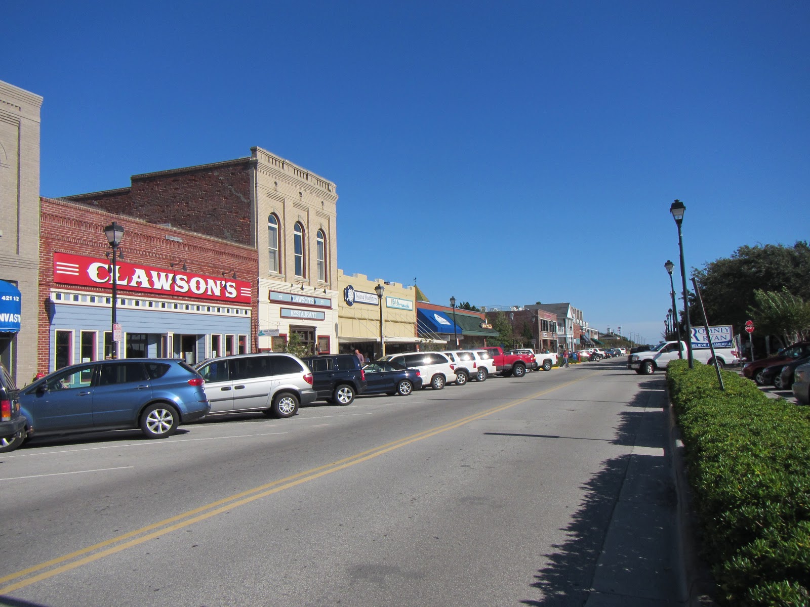
A nice, long walk to East Bay Park & Morgan Park; tennis courts, baseball diamonds & location of Farmers Market May to Oct. 13 & lovely homes along River Rd. but especially Greenwich St. which overlooks saltmarsh grasses on the ICW.  Then walked the historic home district & to many shops on Front St. but did not bring my wallet.  Many stores close on Sat. at 1400 hrs.  A well deserved shower then came the reorganizing the shelves of the V-berth & aft cabin to accommodate our change in sleeping quarters.  Mid afternoon heavy rains & increased north winds moved in but only for a couple of hours cancelling our plans to do Happy Hour (1500-1700 hrs.) at Crazy Fish.  I walked to St. Mary's to attend their 1700 hrs. Mass & returned home & no rain; Mass hours= Sat. 1700 hrs. + Sun. 0800 & 1100 hrs. Two separate suppers prepared as I was having my fresh shrimp tonight.  In fact I boiled up the remaining shrimp then peeled them for future meals.  A late night for both of us working on the internet; Graeme was following info on Hurricane Sandy via Boat US website.  There was no rain during the night, just cloud & a few gusts of north wind pushing the boat against the dock.

Sun. Oct. 28, 2012--Day 26:
Destination:  Georgetown (Mile 403)-- Harborwalk Marina, possible backlashing of winds from Sandy
Winds:  N 10-15K & calming mid morning
Weather:  cloudy to partial cloud with sunny breaks & even full sun & blue skies early afternoon till dark


My powerwalk brought me back to East Bay Rd. via Front St.  It was extreme high tide (full moon 29th) & flooding on Greenwich St. between Front & Prince St.  I caught photos of a truck creeping through the flooded streets with water almost 1/3 up it's wheels & kids playing in the water in their rubber boots with water at times running over the tops of their boots.  Again I don't tire of walking up & down the streets of the historic district (homes dated 1837-1905).  Back at the home front, Graeme untied the blades of the wind generator & sanded the blades, hung our courtesy US flag & Canadian flag, freed the bimini of it's tie down, while I scrubbed the cockpit floor & the deck.  A little shrimp juice dripped in the fridge-- smelly!  So a good wash with soap & water & vinegar was in order.  And carpets were shook & the floors washed.  I met Gary & Linda on their Catalina 42 named 'Makana' (last one built) & reviewed anchorages we used to date & recommended anchorages to the south + info re caution areas & passages.  Crazy Fish was closed today; in fact on Sundays the town is closed up like a drum-- kind of refreshing don't you think!  A soup for supper as neither one of us were very hungry.  Phones & toothbrushes all charged, antivirus programs run & updates downloaded on our computers.  We are ready to move on tomorrow.  One glitch; there is no vacancy at the Charleston Maritime Center till the end of the week.  This may change so we will recheck tomorrow & again on Tues. if necessary.  A light cloud cover tonight & clear view of the full moon.

N.B.  If staying more than 1 night at a marina remember to ask for multi night discount.  When we decided to stay here at Harborwalk a 3rd night they would not apply the reduced rate.  Also to note is 1 week costs the same as 4 days.


Mon. Oct. 29, 2012Day 27:
Destination:  Georgetown (Mile 403) to Dewess Creek #2 (Mile 454.9)
Departure:  0745 hrs.                            Arrival:  1525 hrs.                              Distance: 51.9 SM
Winds:  NW 15-20K & gusty, howling, whitecaps; NW 20-25K in the afternoon but several gusts evening & night
Weather:  cool & crisp, but full sky of blue & sun; H=64F & L=48

As predicted winds from the backside of Sandy was a factor today & to remain so through to Wed.  Sandy was well off shore when she passed Georgia & South Carolina but 350 mi. wide & now has turned to mainland just north of us.  Lots of rain had already fallen in New Jersey (evacuations X 2 days) & NYC, where the metro closed Sun. at 1700 hrs. & bridges, New York Stock Exchange & schools.   High tide with sea surges caused flooding of 1/3 of Manhatten.  From shorts yesterday to long pants, turtleneck & scarf today but by noon are enclosure was like a greenhouse.  We helped the Fleming 65 footer, ‘Towwowie’ beside us off the dock, then ‘Twomorrows’ & then us with the help from Gary (Makana) & good driving by Graeme.  We had a 2K current against us as we traversed Winyah Bay.  Winyah Bay stretches 16 NM from the Waccamaw & Pee Dee Rivers to the Atlantic & is 1 mi. wide at the inlet.  We had a nice ride with 25K winds at our stern approaching Esterville Minim Creek Canal (5 miles long) & especially when turning into the canal.  It was now time to watch for bald eagles, egrets & a variety of birds & alligators as we travel the Santee Delta Region (a huge drainage area secondary to the North & South Santee Rivers, creating a vast grass savanna) & Cape Romain National Wildlife Reserve (nature lovers paradise).  This section of the ICW comprises of numerous rivers & creeks, some deep some shallow especially where they crisscross the ICW & is known as Lowland Country (miles & miles of low lying saltwater marshes).  We saw several dolphins but I suspect it was too cold & windy for those alligators.  Graham Creek Mile 439 looked favourable for these windy west conditions as it has a crop of abnormally higher trees for this area.  We pressed on to Dewess Creek Mile 454.9 & positioned ourselves behind a wide spance of marsh grasses & put out 120 ft. of chain.  There were only 3 of us.  We were positioned 10 miles from Charleston & had a view of the Ravenel Bridge, a spectacular suspension bridge. What a lovely sunset & view of this bridge in the background tonight.  We will be staying here tomorrow as our marina of choice has no availability till Wed. & the wind is blowing X 2 more days.  We heard from Jack & Donna & they are doing a ghost walking tour tonight.  The wind howled & gusted  about 25K all evening & night.  It was partially cloudy & full moon & quite errie.  Will the anchor hold? Will we drag?  Be able to sleep?  We watched a movie as a bit of a distraction from our environment.


I would like to thank so many of you for your emails & phone call of concern & wishes for safe travels!


Tues. Oct. 30, 2012Day 28:
 Destination:  Dewess Creek #2 (Mile 454.9)
Winds:  strong & constant W winds, 15-25K in the am, a relief in the afternoon
Weather:  partial sun but mostly light cloud in the am, more sun in the afternoon, cool,H=62F & L=40’s

Despite an errie & emotionally uncomfortable or worrisome night due to the howling sounds of the 20-27K west winds, I surprising slept well; Graeme stayed up late listening to the radio & the reports of the batter beaten Jersey Coast & NYC from Sandy.  Surely our anchor is well dug in & with this continuing blow all day today it will be interesting when we up anchor tomorrow.  We stayed put today as Charleston Maritime Center had no vacancy for the two of us.  It was a morning of macro cleaning & changing of some linens, tidying up bins & reading & blogging in the afternoon as we listened to the traffic converstion on the VHF.  We also heard the very sad news of the sinking of the ‘Bounty’ 90 miles off the coast of North Carolina in 40 ft. waves; 14 people made it in life rafts & were rescued by the Elizabeth City Coast Guard; 1 body of a 43 yr. old woman was recovered; 1 body (captain) is missing.  Once the sun came out in the early afternoon the enclosure warmed up nicely; warmer & more comfortable reading & doing sudoku there than down below.  There was an additional boat anchored here tonight, a total of 4, + 3 other boats at a different location of Dewess Creek.  Another lovely sunset again tonight with Charleston in the background.    

Friday, October 26, 2012

Week 3: Oct. 17-23, 2012 (Day 15-21)


Week 3:
Wed. Oct. 17, 2012Day 15:
Destination:  Goat Island  (Mile 43) to Alligator River G39 (Mile 101.1)
Departure:  0805 hrs.                             Arrival: 1730 hrs.                                 Distance: 58.1 SM
Wind:  NE-NNE & light, less than 4K
Weather: light cloud with sunny breaks; H= low 60’s & L= mid 50’s

An amazing sunrise!  The reddist sky (sailors beware?), some interesting cloud formation, some blue sky below that, low mist rising over the water that was so perfectly calm that there was a perfect reflection.  We had heavy condensation on the enclosure, which is not unusual for this time of year.  By 0910 hrs. we requested an opening of the Elizabeth City Bridge.  There were boats on the Elizabeth City docks & bulkhead (free X 48 hrs.) but there was still room to accommodate a few more boats.  We encountered a much smaller number of crab pots on the Pastquotank River past Elizabeth City than usual.  The Abemarle Sound was so very calm today but being fairly shallow & the fact that winds have a long fetch from all directions, short steep, uncomfortable seas can kick-up fast.  Fog is not uncommon either in Spring & Fall.  We took the shortcut through the Abemarle travelling about 6K, saw a turtle, picked up fuel for the boat at Alligator River Marina as this is the last opportunity X 30 miles (Upper Dowry Marina) & purchased crab cakes ($3.79 each) for supper for myself; Graeme I guess is having leftovers again.  Once through the Alligator River Bridge (swing) we entered the 21 NM long trek along the Alligator River, a wide open span of water.  This was also very calm with an occasional tease of ENE 4-6K winds.  At G39 channel marker we turned to port & anchored in 9 ft. of water (80 ft. of chain) just before a line of crab pots.  There were other boats anchored in Deep Point (G43) & Bear Point (G47).  Jack rafted to us till dark but ‘Kathrian’ hosted Happy Hour.  Lots of charging time required tomorrow of phones & computer.  At bedtime there were clear dark skies & stars+++.

Thurs. Oct. 18, 2012Day 16:
Destination:  Alligator River G39 (Mile 101.1) to Campbell Creek off Goose Creek ( Mile 154.5)
Departure:  0800 hrs.                         Arrival:  1545 hrs.                                    Distance: 53.4 SM 
Winds: E <3K
Weather:  mostly cloudy, threatening skies, few drops of rain in early a morningà replaced by blue skies & sun & warm temps; increased cloud in the afternoon but still warm (H=70’s & L= upper 50’s)

I awoke to the slapping of water against the hull & a gentle chop & sideways rocking motion.  We entered the 22 mile long Alligator River-Pungo River Canal at 0840 hrs.  It runs in a NE to SW directions, is very scenic & heavily wooded at the upper end & areas farther that had burned in the past now show signs of 2nd growth.  Each year more trees topple into the water so staying mid channel is mandatory.  I sighted an alligator at Mile 110 .  There were more crab pots at the north end than in the past.  After the Wilkerson Bridge (fixed) at Mile 126 the ICW buoy markers reverse. The Pungo River is an auxiliary water to the Pamlico River; it is 30 NM long (headwaters at Washington) & 35 NM at it’s widest point; several good anchorages to hide in bad weather.  The Pamlico & Neuse Rivers empty into the SW corner of Pamlico Sound.  North Carolina’s prominent wind direction is NE & SW.  Due to it’s position the Pamlico River is less subject to rough waters unlike the Neuse River.  Pamlico Sound is the 2nd largest landlocked body of water on the eastern seaboard; 70 MN long from Croaton Sound to the north to Core Sound to the south; great cruising waters weather permitting.  Lot of powerboat traffic today.  Clouds started to move in about noon & steadily increased.  Jack had his sails up & bobbing along until we caught up to him close to the entrance of the ICW into Goose Creek.  And at G15 we turned into Campbell Creek & carefully sounded our way in seeing 7-8 ft. depths & some crab pots that were unusually easy to follow unlike the past.  We anchored with 70 ft. chain in 8 ft. water.  There were 4 boats in total.  The western sky was so picturesque with a red sunset despite the cloud cover.  Another calm night+++ & clear skies & stars at 0430 hrs.

Kathrian


Fri. Oct. 19, 2012Day 17:
Destination:  Campbell Creek (Mile 154.5) to Beaufort, Town Creek Marina Anchorage (Mile 203.7)
Departure:  0800 hrs.                           Arrival:  1530 hrs.                          Distance: 49.2 SM
Winds:  SW, light 3-8K on Bay River, flat calm on the Neuse River, light on Adams Creek & 10-12K winds at anchorage
Weather:  partially sunny & cloudy skies, warm, light fog à dark grey clouds to the west with brief light rainà blue skies & sun à partial cloud & pink sunset à clear & stars with ¼ moon
Kathrian in the Morning Fog


A mist hovered over the calm water at sunrise.  There was a question of rain & thunderstorm with warm temps in the upper 70’s.  Good weather is also necessary when crossing the Neuse River due to it’s vastness & shallowness, thus prone to steep, uncomfortable seas.  Warmer temperatures are usually felt at this latitude because the Gulf Stream begins it’s course toward Europe off Cape Hatteras which lies just north of us.  The Bay River is more like a bay than a river; many miles of isolated by lovely cruising & picturesque shoreline & overnight anchorages; stretches from Gale Creek to Maw Point where it meets the Neuse River.  The Neuse River is named after an Indian tribe that inhabited the area; it is 34 NM from it’s mouth to New Bern X 6 NM at it’s widest point; little lunar tides but sustained winds from the S & SW lower water levels significantly & blows from the N & NE raise water levels; many picturesque coastal towns, the largest being New Bern.  We attempted to sail on the Bay River with short lived SW 5-8K winds.  The Neuse was flat calm, like a mirror after a brief rain shower from the dark clouds to the west.  In Adams Creek we motored along while I did SUDOKU & made lunch.  We took the Russell Slough to the anchorage off Town Creek Marina which was somewhat crowded.  Our first attempt to anchoring south of the marina found us touch the mud bottom (shoal) & we moved to just west of the marina fuel dock dropping only 50 ft. of chain.  Happy Hour was on SCT.  We plan to stay here tomorrow to sightsee & Jack is in need of some provisioning.  Clear, starry skies with ¼ moon & a constant 10-15K SW wind blew all evening & most of the night, so the wind generator also worked most of the night.

Sat. Oct. 20, 2012Day 18:
Destination:  Beaufort, N.C. (Mile 203.7)
Winds:  who cares, O.K. W to NW, light to 8-10K , light again all evening, increased to 10-15K during the night
Weather:  sunny, few clouds which dissipated entirely, H= near 70F & slightly cool night with northerly winds

A nice relaxing breakfast followed by boat showers.  Once ashore we noticed that the marina was not busy & they were most happy for us to use their shower, laundry facilities & internet.  Also they were willing to allow us to use the courtesy car but the boss was using it.  Maybe later, but no it would not be available till tomorrow; nevertheless it was very generous of the staff.  Internet, fuelling up the boat then refilling the jerry cans X2 & a dinghy ride into Taylor Creek where we tied up to the free municipal dinghy dock & had a very pleasant time walking Front St. (adjacent to the harbour front), in & out of stores, lunching outdoors in the warm sun on the patio at Finz overlooking the harbour (filled with mostly sailboats on mooring balls & tourboats coming & going), wandering the streets away from the waterfront looking at & taking photos of some of the historic homes, strolling through The Old Cemetery on Ann St. & shopping for some provisioning for Jack at Coastal Community Market (Queen & Broad St.) & a new market that opened in March on the corner of Front & Queen St.  We had hoped to explore Carrot Island but it was getting late in the afternoon—disappointed.  After a drink on the upper deck of the marina house outside ‘Fish Tails’ as the sun was setting we were wined & dined on ‘Kathrian’, a scrumptious omelet with spinach & feta, salmon & broccoli.  The night skies were clear, filled with stars with calm NW winds until the middle of the night when they picked up considerably letting the wind generator do it’s thing.


Sun. Oct. 21, 2012Day 19:
Destination:  Beaufort (Mile 203.7) to Mile Hammock Bay (Mile 244.5) 
Departure:  0820 hrs.                                 Arrival:  1545 hrs.                                 Distance:  50.8 SM
Winds:  NNW starting at 10-12K & diminishing through the morning to 4K
Weather:  cool breeze, sun & blue skies, warm in the sun

Happy Birthday Reid!  We hope you are enjoying your special luncheon!
The anchor was up at 0820 hrs. & where the chain had been lying on the mud bottom & the anchor (45 lbs. CQR) was covered in tenacious black, stinky mud.  We made the 0830 hrs. opening of the Beaufort Bridge (bascule) then proceeded toward Moorhead City.  It was low tide but now rising.  As we motored past Moorhead City I was reminded of the reconstruction of the overnight dock at Sanitary Fish Market & Restaurant (now $25.00) & the free floating dock almost always occupied at Ruddy Duck Tavern.  As we rejoined the ICW we sailed along under jenny on a close reach down Bogue Sound in our shorts & T-shirts in a mainly west direction for about 17 NM.  A school of dolphins dove & surfaced between ‘Sweet Chariot Too’ (SCT) & ‘Kathrian’—our first dolphin sightings.  Bogue Sound is long & shallow; one must pay close attention not to weave from red mark to green mark in order to stay in the narrow deep water, otherwise it shallows to 2-3 ft.  At G17 we drifted & went aground; quickly we furled sail & thankfully motored off quite easily. The north shore is lined with beautiful homes.  The Bogue Banks well to the south are a series of low barrier islands separating the sound from the ocean & are sandpits with scrub brush.  The current in Bogue Sound increased to 2.5K against us as we approached closer & closer to Bogue Inlet where it then reversed.  This will be typical as we continue to approach & pass the many inlets.  Our boat speed went from 4.2K to 8K.  From now on tidal currents steadily increase through North & South Carolina into Georgia.  Hammock Beach Park (Mile 232) is a wilderness park with impressive high dunes but only accessible by small boats or making arrangements with park services pontoon ferryboats.  We had our choice of spots when we reached Mile Hammock Bay (Mile 244.5); by nightfall there were a total of 10 boats.  It remained warm till 1700 hrs.  A magnificent sunset followed then the dark sky was clear, filled with stars & ½ moon & very still water.


Mon. Oct. 22, 2012Day 20:
Destination:  Mile Hammock (Mile 244.5) to Banks Channel, Wrightsville (Mile 283.2)
Departure:  0730 hrs.                            Arrival: 1530 hrs.                                           Distance: 38.7SM
Winds:  N < 5K
Weather:  brilliant sun & blue skies

Unfortunately we are at low tide & soon to reverse & at the New River Inlet which has a constant shoaling problem & a swift tidal current.  In fact sometimes the inlet & ICW are closed.  Three sailboats set out before us & one was aground as we approached R72A; he favoured the red side too closely.  But the rule still applies—favour red side at R72 & slightly less so at R72A, then follow the sinuosity of the port shoreline to R74; R72à12 ft., R72Aà 7 ft., R74à14 ft. We had 3 bridges to open to Wrightsville: (1) Surf City Bridge (swing) 16.2 SM on the hour; allow a little more than 2 hrs. from Mile Hammockà passed through at 1000 hrs. opening (2) Figure Eight Island Bridge (swing) 17.4 SM on the hour & half hour; allow 2-21/2 hrs. from Surf City Bridgeà passed through at 1230 hrs.; I believe we could have made the 1200 hrs. opening if we had motored a bit faster & had even tried for the opening, then we would not have had to wait 1:50 for Wrightsville only 5 miles away  (3) Wrightsville Bridge (bascule) 5 SM on the hour; strong current; passed through at 1400 hrs.  We had a high tide going through Motts Channel + G19 & 21 towards Banks Channel had been moved to their more rightful spot.  Along the route today we spotted a number of my friends, the dolphins.  As we passed Seapath Marina we pulled in for fuel & water.  The staff were most pleasant & accommodating.  Even though we were not staying there they allowed us to use their laundry (1 washer= $1.25 1 dryer= $1.00), shower & internet services  after we dropped the hook in Banks Channel Anchorage.  There was plenty of room when we arrived but many boats then trickled in.  I don’t know the exact number of feet of chain we dropped as the chain markers were caked with black mud.  A spectacular view of the red sunset.  Finally supper, baja mex food at Tower 7 just up from the dinghy dock at Wynn Plaza.  What a pretty sight of all the boats’ anchor lights on our dinghy ride home on such calm, mirror like water.  The sky was crystal clear, ½ moon & stars.


Tues. Oct. 23, 2012Day 21:
Destination:  Wrightsville, N.C. (Mile 283.2) to Calabash Creek, S.C. (Mile 341.7)
Departure:  0730 hrs.                                  Arrival: 1530 hrs.                                Distance: 58.5 SM
Winds:  N, but none to speak of
Weather:  sun, sun, sun, blue, blue sky & warm

Happy Birthday Marcie!  And Happy Birthday Jack!


Another awesome sunrise + sounds of more southern birds.  We are experiencing more interesting sights & sounds of southern nature & wilderness but also the southern drawl of local people.  The anchor was absolutely clean when we took it up; I could actually see the chain markers again.  We took the Shinn Creek (deeper) exit from the anchorage back on the ICW as the tide was still falling till 0925 hrs. & thus we were motoring against a 2K current.  We had good depths nevertheless until we hit Myrtle Grove Inlet G141 & G143 (8.8 ft.) & approaching Carolina Beach Inlet R150 & R152 (7.1 ft.).  Snows Cut connects Carolina Beach Sound to the Cape Fear River but it ebbs & floods from Carolina Beach Inlet.  Cape Fear River ebbs & floods from Cape Fear Inlet.  We were running Cape Fear River down to Southport (12 NM) with the tide at a boat speed of 8.8K.  The 3K north winds were from the stern & of no help.  In fact the water surface barely showed a shiver of movement.  It was the fastest trip to Southport.  Approaching Lockwoods Folly (Mile 321.5--caution area) at 1250 hrs. our boat speed was down to 4.2K, but good depths, turbulence++, small recreational fishing boats & increase of boat speed to 7.8 on the other side.  Likewise for Shallote Inlet (Mile 329.5—caution area); decreasing boat speed approaching the inlet, good depths, turbulence, increase boat speed past the inlet.  Nerve racking was a damn big power cruiser who had to pass as we were jostled in the turbulence & diligently following the shoal markers.  Welcome to South Carolina at Mile 340.8!  A shoal bar cuts across the entrance to Calabash Creek & the proper approach is by directly facing ICW 2 make a 90 degree turn to starboard keeping that marker to port & giving CC 2 marker a wide berth over the shoal bar, but with high tide water depths were 8-9 ft. Tides in this area is about 2-3 ft.  Five boats were already anchored & although not much room we managed to anchor in 12 ft.  We were a total of 9 boats tonight.  Another lovely sunset, ¾ moon, stars until light fog set in early night for a short period of time then clear & starry sky again.


Week 2: Oct. 10-16,2012 (Day 8-14)

Week 2:
Wed. Oct. 10, 2012-- Day 8:
The day started almost warm & cloudy, with a high level looking form of fog that just felt it would burn off.  Soon blue patches were visible, then sunny periods, until there was wall-to-wall blue sky & full sunshine.  Wind was WNW to W & light to moderate gusts.  All in all a most pleasant day.  Activities of the day included a 40 min. power walk, shower & in working shorts & sleeveless T-shirt  attire, I cleaned the deck & teak rail & started the cockpit; hopefully I will finish all tomorrow.  Sid showed Graeme how to tighten the loose port & starboard small hatches.  Graeme discovered a problem with a increasing very stiff dump valve for the head; sure enough a new part had to be ordered & departure date is set for Sat.(stay tuned).  He also obtained more bits & pieces in town, shock cord from Ullman Sails for the new winch covers I had made back in Ottawa & picking up the plastic side curtains from Ships Tailor (straps shortened).  With the improved sunny days & warmer temps we seemed to have an invasion of fruit flies & plain houseflies, not those ankle biting variety, despite relocating the apples & onions outdoors.   We got the fly swatters out & fly tape set up-- gotcha!  Such calm water & what fabulous lighting in Broad Creek at sunset.


Thurs. Oct. 11, 2012--Day 9:
Before first light the sky was absolutely filled with brightly shining stars.  The same was true at bedtime.  Daylight brought a brilliant blue sky & wall-to-wall sunshine, although the temps were cool & the winds gusting 10-15K from the north; too cool to hose down the cockpit & transom (H low 60's).  Fortunately they diminished after noontime.  So in the morning I did 3 small loads of laundry, assembled my bike & pumped the tires & took a spin to the point to see the whitecaps on the Rappahannock River & internet.  After lunch I tackled the unfinished cleaning of the cockpit & transom.  I had cold feet from being in the shade, in water & the cool temps.  Graeme once again managed to get out of "scrubbing the decks" by tootling around town etc.  He was unhappy with the small leaky hand pump on the head so replaced it & had to purchase a spare replacement.  The fruit fly & housefly population did not worsen as the fly tape was doing it's job, otherwise I was ready to try Jeannie's recommendation of a dish of vinegar & Dawn dishwashing soap.  A second night of absolute calm & magnificent sunset colouring to the creek.  We were told of the late arrival of 'Sybaris', a Jeanneau 45DS near sunset & helped with their arrival.  I phoned my sister in Ottawa & all is set-- she, my brother-in-law & Mom are leaving early afternoon tomorrow & driving part of the way to Williamsburg, where they have arranged a time share accommodation for a week starting Sat. Oct. 13th.  We will all meet on Sunday in Norfolk.  None of my family have seen this boat or fully understand what Graeme & I are doing.  Nice clean linen on the bed (cozy flannel bottom sheet) & the heater plugged in as the night temps were once again in the upper 40'sF.

Fri. Oct. 12, 2012-- Day 10:
Another glorious morning sky at sunrise, coolish temps (40's) but sunshine & clear blue skies.  North winds picked up mid afternoon & 20-25K N winds unfortunately predicted for tomorrow am but to subside by afternoon.  Graeme took the BBQ tank to Revere Gas to be topped up as well as one of two house propane tanks while I washed windows inside & out.  The dumping valve part arrived after noon & work began with the boat slightly lifted out of the water by the travel lift.  We skipped into town to say our goodbyes to Jeannie (maybe laid off for the winter) & other last minute errands.  Murphy's Law-- of course the job was not simple.  On our return, 'Sweet Chariot Too' was completely hoisted out of the water & sitting in slings on the travel lift on land, but the job was near completion.  Now remember, this is Friday & it is now after 1700 hrs. & we planned to set off early in the morning for Norfolk, as we have made arrangements for my family to meet on Sunday.  I am now disappointed, anxious & angry but I don't know who to be angry with.  I know I am upset because my spotless cockpit & head floors are now dirty, Graeme is walking around with yet another alcoholic beverage in his hand & talking.  My bike has not been moved to the garage yet & the cockpit is littered with ropes & bungee cords & cleaning supplies.  Sid preferred that after the application of 5200 to the through hull we remain on land in the slings overnight.  O.K. but now the wind is howling & gusting 20-30K.  After supper we went over to Jimmie & Larry's boat 'Sybaris' with our drinks-- gorgeous & roomy!  This was the coldest night yet; in the dark we established an electric hookup & turned our AC heater on.  The night sky was filled with stars & an 1/8th moon.  My alarm was set for 0530 hrs. wake up.

Sat. Oct. 13, 2012-- Day 11: 
Destination:  Deltatville   (Mile 159.6) to Norfolk (Mile 0) Waterside Marina ($1.50/ft.)
Departure:  0820 hrs.                                   Arrival:  1720 hrs.                           Distance:  59.6 SM
Winds: N 15-20K, small craft warning till 0900 hrs. à NE 10-15K with 1-3 ft. waves & whitecaps à3-6K
Weather:  cold but beautiful clear & sunny morning; sliver of moon visible at first light; H low 60’s & L low 50’s

A sliver of moon was visible at first light. Ken, Sid & Cliff arrived & at 0700 hrs. as promised we were dropped back into the water.   A test pumping of the head was done for any signs of water leak but all was good.  All was stored away for a possible bouncy ride on the Bay.  We checked the wind & water conditions by observing ‘Sybaris’ from the point; some pitching.  We delayed departure by an hour then pushed off the dock at 0820 hrs., poking our nose into the Rappahannock; not too bad .  Hurray, we are on our way!  When possible we unfurled the jenny & within an hour the wind & waves decreased.  We unfurled the main & the winds & waves continued to decrease to 3-6K & the boat speed was only 3-5K.  We furled all the sails & turned the engine back on so we could make Norfolk today, before dark.  There was reasonable cargo ship, tugboat & sailboat traffic as we turned off the Chesapeake onto the Elizabeth River.  We made reservations early in the morning for Waterside Marina for 3 nights as we felt this was the best arrangement to meet with my family tomorrow & in a couple of days with Jack Verheyden.  Graeme insisted on having supper at Hooters, located right at dockside; I wonder why?  A clear starry night.


Sun. Oct. 14, 2012Day 12:

Destination: stay in Norfolk at Waterside Marina (Mile 0)
Winds: light NWà increasing to 10K early afternoonàback to light
Weather: sunny, clear blue skies, warm with H mid 70’s

We both took lovely long showers in the marina & tidied the boat for the arrival of our guests.  Shortly after 1000 hrs. we met with Mom, Donna & Tom in front of the marina.  Note Jim Watson & Ottawa Counselors: free parking on Sundays!  It was  perfect conditions to take my non-sailing family  for a tour of the Elizabeth River waterfront.  For 3 to 3-1/2 hrs. we motored past Naval Station Norfolk, the largest naval installation in the world & homeport of aircraft carriers, cruisers, destroyers, frigates, nuclear subs & admiral barges.  The world’s  merchant fleet loads & unloads cargo at Hampton Roads & the Elizabeth River piers.  We then planned a very late lunch at Granby St. Pizza but were very disappointed to find that it was closed on Sundays.  Instead we ate next door at Jack Quinn’s Irish Pub.  Next was a car tour past St. Paul’s Episcopal Church, St. Mary’s Basilica, Chrysler Hall, Norfolk Scope (home of the pro hockey team, Admirals), to Freemason St. (historic houses, cobblestone road), a walk around the paths & Oriental gardens of the Taiwanese Friendship Pavilion & over to Freemason Harbor to view the USS Wiscousin; earlier we drove by MacArthur Memorial, MacArthur Center & the banking & financial highrise institutions.  Then it was time to say goodbye.  Graeme & I watched the Carnival Glory (huge cruise ship) leave & spin around as it leaves for a week in the Bahamas.  We flushed out the stern tank of the boat with a heavy amount of chlorox via the shower & transom hoses, then filled all tanks & jerry cans with fresh, clean water.  It clouded over at sunset & the evening & night were warm; no heater required.

Mon. Oct. 15, 2012Day 13:
Destination:  stay in Norfolk
Winds:  gusting S to SW, 10-20K & small craft warning
Weather:  cloudy with sunny periods & warm; H 76F  L about 55F, rain & thunderstorms in the evening

A great sleep right through the night.  We got our exercise today—powerwalk after breakfast, then both of us walked the morning & afternoon away.  The marina’s gratis taxi drove us to the gorgeous new 2 storey Harris Teeter (corner of Princess Anne & Colonial) for a few basic groceries; even  equipped with an elevator to accommodate shopping carts.  From there we walked through Historic Ghent (gorgeous well maintained homes & gardens, but not very historic looking), The Hague (Mowbray Arch & Botetourt St.—more historic houses), Chrysler Museum of Art (under construction & open Wed. to Sun.), into Freemason Historic District (checked out Shady Grove small market; just basic foods; now the only & closest market to the marina).  We learnt more information about the ground transportation ie senior rates for light rail, bus &/or ferry= $0.75 per ride or one day all day= $1.75 (something else the Ottawa councelors should note.  A prescription glass store was the only place able to clean my Maui Jim sunglasses from annoying & tenacious smudges & streaks—wow, what a difference.  To the Post Office for US & Canadian stamps, then to Granby St. Pizza for a late lunch—the long awaited & best stromboli.  We split one & ordered another to take home for a future supper.  We walked through MacArthur Center as we made our way to the boat, then the decks got hosed down with fresh water as the skies grew darker & darker.  Finally at about 1700 hrs. the  winds increased, the skies opened up. The rain was accompanied with lightning & thunder till 2000 hrs. as we both worked away at our last chance at emails.  The strong southerly winds persisted all night till after sunrise the next morning.

Laura, you must remember to remove the cockpit mat when it rains!

Tues. Oct. 16, 2012Day 14:
Destination:  Norfolk (Mile 0) to Goat Island, Dismal Swamp Canal (Mile 43)
Departure:  0810 hrs.                              Arrival:  1800 hrs.                                  Distance: 43 SM
Wind:  N & NW about 20-25K before dawn, 8-10K after sunrise & motoring south down Elizabeth River
Weather: sunny, few scattered clouds & blue sky; H= 60’s & L= 50’s


Alarm off at 0600 hrs., shower, breakfast & off the dock at 0810 hrs.  Jack Verheydan returned late last night from Nova Scotia & in our company for several days to come.  Several boats were similarly on the move; 12 boats & 1 tug as were passed under the Gilmerton Bridge at it’s 0930 hrs. opening.  Word was from two days ago that the Corps of Engineers had removed trouble-some deadheads in the Dismal Swamp Canal (DSC).  Nine boats proceeded to DSC Deep Creek Lock.  We were locked through early rising approx. 9-12 ft. then through the Deep Creek Bridge  less than a mile away by 1144 hrs. by the same lockmaster & bridge tender, Robert & a trainee.  The word dismal actually means “swampy land”.  The DSC or Ditch is set out in two arrow straight tracks for 21.9miles from lock to lock.  One has a magnificent view of swampy terrain comprising of tall cypress tress with garlands of vines intertwined in their branches against dark chocolate brown tannin water from tangled roots in the forests along the shores.  Four other boats & ourselves easily made the last opening of the South Mills Bridge & Lock at 1530 hrs.  by another very pleasant bridge tender/lockmaster.  We were dropped 9-12 ft. into the Pasquotank River whose surface was covered in lime green tree pollen or algae which abruptly stopped at the old RR bridge.  At G13 we turned into Goat Island  & sounded our way in.  Rafted to ‘Kathrian’ we had a celebratory drink followed by more drinks & dinner on ‘Sweet Chariot Too’.  The water was absolutely calm, mirror like & the skies were clear filled with bright stars.