Saturday, April 20, 2013

Week 29: Apr. 17-23, 2013 (Day 197-203)


Week 29:

Wed. Apr. 17, 2013—Day 197:
Destination:  Wahoo River (Mile 630) to Turner Creek, Savannah (Mile 585.5)
Departure:  0755 hrs.                               Arrival:  1540 hrs.                            Distance:  44.5 SM
Winds:  NE 8-17K depending on proximity to Sounds & Inlets, calm at sunset
Weather:  warm sun but cool breeze with clouds to west & south, clouds at sunset

All the Sounds & Inlets that affect our Tidal Currents
A calm & warm night.  A warm bright sun most of the day but the breeze was cool.  In Johnson Creek we were warned to pass close to markers G131A & G131 for best depths.  Large pods of dolphins were seen in Johnson Creek & especially North Newport River; in fact one leaped completely out of the water twice or it was 2 separate leaping dolphins!  NE winds increased to 15K in St. Catherines Sound & we were motoring against an incoming (flood) tide from the inlet with of course the wind on our nose (speed= +/- 4.5K).  We were able to use a little jenny when we turned down in the Sound away from the Inlet toward Bear River, with a slight reprieve of the opposing current through Bear River until we exited Florida Passage into the Ogeechee River.  Here once again the wind was on our nose & we were now experiencing a flood tide from the Ossabow Sound & Inlet (speed= 4.8 with 12K wind).  We hit Hell Gate passage at 1235 hrs., about 2 hrs. before high tide; mostly 13 ft. except 11.3 ft. crossing over the shoal & 15 ft. exiting to R36.  We were now off the wind as we turned down the Vernon River & set some jenny (speed= 7.0K), then furled the sail as we turned into Burnside Creek.  This was another serpentine route, now through marsh grasses on one side & residential, big expensive homes onshore.  The Skidaway Narrows fixed Bridge was still under construction but the bascule bridge opened quickly on request.  The tide was still rising as we left the ICW to cross Wilmington River into Turner Creek; good depths of 12-15 ft.  Anchoring was a bit interesting as the wind was 90 degrees to the incoming (flood) tide.  Clouds arrived right at sunset.  A few pale & dark pink streaks in the clouded sky.  ¼ moon was visible through the light night cloud.

A Wahoo River, Georgia Sunset
Thurs. Apr. 18, 2013—Day 198:
Destination:  Turner Creek, Savannah (Mile 585.5)
Winds:  E 5-10K
Weather:  mostly sunny & warm once morning clouds moved off, few clouds in the afternoon

In famous Savannah Squares in Spring
A warm night & also I must mention that for several weeks now we have experienced condensation & moisture at night, especially on deck & the enclosure & heavy in the morning; the enclosure windows required wiping before setting off in the morning.  We dinghied & tied up to Hogan’s Marina before they open at 0800 hrs.  We walked across from the Publix on Johnny Mercer, were attacked by gnats & caught the CAT #10 bus at 0830 hrs. (seniors rate--65 yrs.= $0.75 each).  The Cat route & schedule for some runs must have changed on Apr. 8, 2013 according to a posted sign, but that did not affect us.  The morning ride in was most interesting as the friendly riders usually African American, spoke easily & freely with us, offering suggestions & a few on entering the bus loudly bid “good morning all!”  The 1 hour bus ride brought us to downtown Savannah at the corner of Martin Luther King & Broughton.  Graeme & I split up for the morning to do our own touring & met up at City Market at noon;  I walked all the squares I had not done in the Fall south of Liberty St. including Forsyth Park & Colonial Park Cemetery, enjoying the architect, the wrought ironworks of the old houses, the greenery & the flowering shrub bushes in blossom & the roses.  The front façade of the Cathedral of St. John the Baptist was totally behind scaffolding, restoration efforts, as well as the exterior of Juliette Gordon Low Birthplace building.  Graeme seemed to have stuck to the City Market & River St.  We walked along River St. from City Hall east, lunch at Cotton Exchange on River St. & afterwards lazily walking under Factors Walk down to & west to Broughton.  Believe it or not I declined ice cream at Leopolds.  We caught the 1530 hrs. #10 bus back to East Savannah.  We picked up a few groceries at Publix & Graeme paid Hogan’s Marina their $10.00 dinghy fee where we met a pet pig called Lucy.  The dinghy & motor were lifted for tomorrow’s departure.  A wonderful sunset as the sun went below the saltmarsh  grasses & a peachy coloured sky.  A half moon tonight in a mix of clear & cloudy skies.


Fri. Apr. 19, 2013—Day 199:
Destination:  Savannah, Georgia (Mile 585.5) to Port Royal Landing Marina, Beaufort S.C. (Mile 539.6)
Departure:  0650 hrs.                               Arrival:  1440 hrs.                                  Distance:  45.9 SM
Winds:  S 8-15K in protected rivers & creeks, 15-29K in more open water
Weather:  cloudy, warm & humid

Dreamy Beaufort, S.C.
The south winds increased about 0400 hrs., light cloud increased to heavy cloud & the predicted high winds did materialize in the afternoon.  We left the anchorage early, 2-1/2 hrs. before low tide to make sure we could pass the shallow entrance without grounding & attempted to make the 0800 hrs. opening of the Causton Bluff Bridge (bascule), but were 3 min. late & now had to wait a full hour; the tide was against us from the anchorage into & along the Wilmington River, then slowly the tide had less of an opposing effect on our speed as we got closer to the bridge.  But now we were only ¾ hour to maximum low tide & precisely at that time we crossed the Savannah River & entered Fields Cut, a notorious shallow area; 5’4” on entering the cut, 11-14 ft. most of the way through with 1 shallow area midway & 10-12 ft. exiting the cut into the Wright River.  The New River had varied but good depths also with 1 exception.  From Ramshorn Creek we entered Cooper River & partially rolled out the jenny to assist with the opposing current from the flood waters from Calibogue Inlet & kept our speed to a respectable 5-6K range by playing the jenny in & out & jibbing at times around the circuitous route.  When we turned away from the inlet towards Hilton Head, we were with a favourable pushing tide motorsailing along at 7.0-7.8K down Calibogue Sound, now with building 1 ft. waves & some whitecaps.  We continued to play the jenny as required through the deep flooding waters of Skull Creek.  Out into wide open waters of Beaufort Sound, the current was opposing, the winds were gusting 15- 29K, the waves were heavily whitecapped about 2-3 ft. high on our beam & some crashing over the boat.  We reefed the jenny as the boat was heeling with gusts of 25-29K, forcing one to brace themselves when at the helm, until we could bare off towards Port Royal & Beaufort (pronounced Bewfort) now with pushing tides.  We were assigned a dock tie up on the inside of the north end of the face dock but between 2 power boats & that was a problem with the winds, the tides & the current; our stern nearly side swiped the starboard side of the 1st power boat.  I was upset to say the least & trembling afterwards & really needed that hot shower.   Graeme as usual said nothing but busied himself adding another spring line, attaching electricity (I can’t remember the last time we were plugged to shore power) & topping the boat’s diesel tank.  Chef Larry invited us & Pat & Fred (Marianna-met 2 yrs. ago) over for a wonderful pizza & key lime pie dinner.  We had a enjoyable evening finally reuniting with Lynn & Larry, distracted with lots of conversation while a storm was occurring outside.  There was another tornado & thunderstorm warning approaching from the west with winds shifting to the north & bringing cold temperatures.  We were hit with heavy rains & 30+K winds & lightning, rocking boats at dockside+++ & slamming them against the dock, but it was over in a few hours.  I might add that ‘Marianna’ was hit by lightning as they were travelling north with ‘Twomorrows’ from Dinner Key to Ft. Lauderdale in a wicked storm with 22K winds at the beginning of April; lost their GPS, autohelm, radar, instruments, VHF & refrigeration temporarily with the exit strike likely out the mast decklight that was blown to smitherines.  Back at the boat I worked till 0100 hrs. trying to purchase & install my antivirus program soon to expire, with great difficulty requiring chat line tech help.  Fortunately the winds & waves calmed down.  But the forecast is not at all good Sun. through Tues.  Decision time in the morning.

Sat. Apr. 20, 2013—Day 200:
Destination:  Port Royal Landing Marina (Mile 539.6)
Winds:  NE +/-20K, decreased early afternoon to 5-10K by sunset
Weather:  cloudy & cold! H= 60’ish only & L= mid 40’s! Thinning clouds early afternoon & sun & clear skies late afternoon

Port Royal Soft Crab Festival
The rains continued on & off during the night.  By morning heavy moisture surrounded the windows.  Having gone to bed so late, I was feeling very tired & not wanting to get up.  ‘Twomorrows’, ‘Marianna’ & ourselves had a conference talk on the VHF at 0730hrs. & all unanimously agreed they were staying another night; in fact Lynn & Larry & ourselves decided to stay 2 nights as Sundays weather is dreadful (stay 2 nights, get 3rd night free).  Cloudy, cold, windy just plain miserable; certainly not the weather you would expect at this time of year at this latitude.  But I made real toast with a toaster this morning!  I had intentions of baking muffins or cinnamon rolls which would help warm the interior up, but my morning was occupied still trying to install the antivirus program on our 2 other laptops (2 of 3 successful) & edit my password for my account; hours on chat line with tech help.  Graeme worked at washing the enclosure windows, cockpit floor & cushions with FRESH water & added water to one of the boat tanks. Early afternoon we used the courtesy vehicle to visit Port Royal’s Soft Crab Festival; booths of crafts, jewellery, T-shirts , food & beverages & even vintage cars.  Quickly we drove to historic downtown Beaufort for a oil print Graeme had seen in the Fall of a shrimp boat in saltwater marsh grasses at Fordham Market, a converted hardware store into multi consignment craft units.  Late afternoon Graeme worked on his >200 emails, while I updated my blog & added pictures.  The sun appeared as the sky cleared totally a few hours before sunset.  We had a social hour at ‘Twomorrows’ & said our goodbyes to Fred & Pat as they need to move on tomorrow.  Calm water, clear sunset sky, clear night sky & ¾ moon.


Note the Palmetto Palm in the Green Shutters
Licence Plate--'56 T- Bird


Sun. Apr. 21, 2013—Day 201:
Destination:  Port Royal Landing Marina (Mile 539.6)
Winds:  gale force advisory NE 15-20K in am & 20-35K late pm & night
Weather:  crystal clear, sunny & cold + made cooler with strong breeze, cloudy mid pm, rain

Lowcountry Saltmarsh Grasslands, Live Oaks & Spanish Moss
I was slow to rise on this bright, clear, cold but sunny morn as I had another late night.  At 0800 hrs. NOAA announced a gale force advisory for the Beaufort area from 1100 hrs. to 0600 hrs. tomorrow.  Cold NE winds of 15-20K started soon after 0900 hrs. & by late afternoon were in the 20-35K range.  The Beaufort River was an ugly sea of white, with good 2 ft. waves rolling south, crashing into boats tied on the outside of the face dock & crashing into the face dock.  I had a busy morning changing the bed linen, doing 2 loads of wash, shower & internet; washers (1 front load + 1 top load) =$1.00 ea. & dryers (1 front load & 1 large commercial with 70 min. cycle) = $1.00 ea.  At noon we borrowed the courtesy truck & the Morrows & ourselves drove to Historic Downtown Beaufort & had lunch at Luther’s, then casually walked along Bay St. popping into a few shops.  Having a pre-dinner drink on ‘Twomorrows’ we all said how glad we were to be here & with these weather conditions.  Besides, the marina staff Tom, Rion, Tony, Chris are so friendly, accommodating, personable & knowledgeable; this is one of the very best marinas!  ‘Marianna’ left this am & texted the Morrows saying they were anchored in Toogoodoo Creek (Mile 495.4) but would be doing anchor watch tonight.  No sunset after such a brilliant sunny morn, no moon, only cold, vicious, howling NE winds, waves slapping at the hull, rain & dark errie night. 


Mon. Apr. 22, 2013—Day 202:
Destination:  Port Royal, Beaufort (Mile 539.6)
Winds:  NE 20-25K, decreased late afternoon to 15-20K
Weather:  cloudy am, few raindrops , then full sun mid afternoon

Note the length of the dock from Marina Office to ICW
Mud Flats at low tide at Marina
NE winds howled & blew like stink most of the night with a few noticeable lulls now & again.  No question, the Morrows & ourselves were staying our 4th day; oh, I forgot to mention yesterday was our free day.  There was no way we could have gotten off the docks, especially from where we were positioned, without an incident.  NOAA reports & all of Lynn’s sources indicate improving & more favourable conditions tomorrow.  I actually baked up some cinnamon rolls this morning which warmed the cabin.  I have been spending much time the last few days & again today on my blog, posting pics for the many weeks I did not have stronger enough internet to do so & adding captions to pics from day 1, if you can believe.  Very late morning after showering, we used the courtesy truck for a short time to Lady’s Island to Bakers Marina & Publix, then cooked up a pot of chili for supper tonight.  The Beaufort River by this time was less whitecapped & ugly.  Both of us utilized the sunny & warmer afternoon + our last chance with fresh free water & electricity to do some serious cleaning; Graeme washed more of the deck & removed some rust & stains from the deck; I vacuumed & washed with chlorax & pinesol all the lined bins from bow to stern below the floorboards which we use for storage as they are bone dry, in an effort to make the tasks lighter & quicker when we reach home base & put ‘Sweet Chariot Too’ to bed for the summer.  Larry baked up some cornmeal muffins to accompany our chili dinner together tonight.  I did not take note of the sunset sky tonight.  A clear night sky filled of stars+++ &  a 7/8 moon & much calmer winds & sea conditions.


Tues. Apr. 23, 2013—Day 203:
Destination:  Port Royal Landing Marina, S.C. (Mile 539.6) to Church Creek (Mile 488.2)
Departure:  0815 hrs.                          Arrival:  1625 hrs.                              Distance:  51.4 SM
Winds:  NE 15-20K, decreased to 10-15K especially in more open waters & 9-12K in protected areas & calmer through the afternoon with a shift to E then SSE 5K by sunset
Weather:  cloudy & cold, mid afternoon the sun tried to break through & clear late evening

Note the mud banks, the new saltmarsh grasses & zoom into the alligator sunning
I got that last shower in before dawn & departure time.  I was worried about getting off the dock, but Tony was superb once again; it was slack high tide & he released the midship & stern mooring lines, the wind gradually brought the stern out or away from the dock, then Tony took the bow line, walked it along & at the same time pulled the bow right around; Graeme powered in reverse just a short time then we motored out into the Beaufort River, which had only a slight chop this morning.  What a difference a day makes!  The time of the tides today were not really in our favour in accordance to the caution shallow depth spots we had to pass.  We made the 0900 hrs. opening of the Ladies Island Swing Bridge along with 5 other northbound & 1 southbound boats.  Brickyard Creek was O.K. on the falling tide & against current until we exited into the Coosaw River; boat speed was up to 7.7K with the wind on our nose motoring towards St. Helena Sound & into the Ashepoo-Coosaw Cutoff #2.  I sure was glad I had put my antiperspirant on this morning through the cutoff; man-o-man was it skinny/low water (6-9ft.) & there still was over an hour before max. low tide!  And I was driving!  Although the depths were O.K. through Rock Creek, the Ashepoo-Coosaw Cutoff #1, the Ashepoo River & Fenwick Cut, it was a seesaw action of our speed, depending which direction the current was flowing at that location in relationship to the inlet, ie flooding or ebbing.  The South Edisto River & Watts Cut were a different matter as we cautiously cut our engine RPM’s through these areas 1 hr. into a rising tide; the depths were low & the muddy shores were very exposed through these narrow passages; we even saw an alligator sunning on the mud banks in Watts Cut.  Finally the narrow ICW widened into the North Edisto River followed by the tortuous Wadmalaw River, with better depths as well.  I tried to sit outside the enclosure this afternoon when the sun was trying to break through the clouds but the breeze was too cold & the sun was more in than out.  We pulled into Church Creek as to: (1) stage for Elliott Cut & it’s vicious current; must go with the current, so on a falling tide, because the water flow originates from Charleston Harbor Inlet; and (2) an early arrival into Charleston & therefore more time to experience it’s romantic air.  We anchored against the strong current as opposed up into the wind which was at our beam in 16 ft. with 100 ft. of chain.  There were 6 boats here tonight.  With very calm winds, it was a very tranquil spot, with only the sound of a variety of birds & soundless but peaceful movement of dolphins through the water.  We will part company with the Morrows early in the morning for our 2 night stay in Charleston, as they bypass Charleston & move on.  But we hope to meet up again at the end of the week.  I seem to still have some trouble with eating supper after 2000 hrs., whereas in the Fall you are looking to go to bed at that same hour.  A magnificent sunset, more magnificent red evening sky & clear night sky with a bright near full moon & stars.

Church Creek


Friday, April 12, 2013

Week 28: Apr. 10-16, 2013 (Day 190-196)


Week  28:

Wed. Apr. 10, 2013—Day 190:
Destination:  Seabreeze, Daytona (Mile 829.2) to St. Augustine (Mile 778.2)
Departure:  0650 hrs.                              Arrival:  1440 hrs.                                    Distance:  51 SM
Winds:  E <3K, increased late am to 5-7K, then <10K early afternoon
Weather:  warm sun but cool breeze, threatening rain clouds at times

Bridge of Lions

Thankfully it was a quiet & calm night + the current did not make any boats at anchor do any crazies & somehow the yahoos around us did not bump us.  We were out of bed before dawn & it was actually pleasantly warm.  We up anchored without difficulty despite the 2 yahoos on either side; I admit I was anxious to have the opportunity to blow the blow horn at them.  Even at this early hour there was a parade of 7 sailing vessels travelling north along the Halifax River with a near 1K current against us (travelling speed= 5.2 to 5.7K).  Lately we have heard much talk of the Marineland Marina, south of Matanzas Inlet at G89; $1.00 per ft., free laundry (1 washer & 1 dryer).  We experienced good depths, varying from 10.3 to 18 ft. around the channel markers of Matanzas Inlet, where we finally started to get a push from the current (6.2 to 6.8K).  Two of the yahoo boats caught up to us at the Crescent Beach Bridge (bascule) & of course wanted to pass; one had the audacity to call the bridge tender when he was over a mile away & asked that the bridge be held open for him; of course the answer was no & he sounded shocked & upset! Daw!!!   The east side of the bridge was undergoing repairs.  A falling tide was very evident as we were still being pushed towards St. Augustine.  Graeme was not paying enough attention & with the south mooring field close in sight he thought he could cut the corner between the red markers, only to go hard aground in 4 ft. water north of R12 & far west of G11.  Rocks for brains came to mind.  Unsuccessful in our attempts to get off after 5 mins. & with the tide still falling, he hailed Tow Boat US; we were unsuccessful in contacting the local office but eventually were successful in creeping towards the deeper water after about 20 mins., just as another boat went aground to the east of us.  Then it was a rush but we made the 1430 hrs. opening of the Bridge of Lions.  Our mooring ball assignment was in the north or San Marco field as requested—SM4.  With ease we connected up to the mooring ball, then Ken from ‘Sail Away’ came over for a beer & chat.  Now late afternoon, we dinghied to the marina office to register ($20.00/ night).  We met Dixie & Rex at the dinghy landing dock.  A welcomed shower & a brief internet connection, enough to email home before it cut out.  We walked to St. George St. & purchased an ice cream; nothing like having dessert before supper.  From our mooring ball we had a lovely view of touristy St. Augustine under night lights.  A clear sunny afternoon led to a cool, clear, red hued evening sky & cool, clear starry night.

Dixie & Rex (Wonderland)

Thurs. Apr. 11, 2013—Day 191:
Destination:  St. Augustine (Mile 778.2)
Winds:  calm SE, increased early afternoon to 15-25K & gusty & howling
Weather:  threatening rain clouds, clearing to partly sunny late am, then a partly cloudy evening

Off the main drag
A grim day of sad news today.  Graeme topped the boat’s diesel tank from the jerry can supply.  At shore he refilled the diesel jerry cans while I disposed of the garbage & did internet; amazing I maintained a connection!  But I learnt of a friend’s recent unfortunate ski accident.  Mid morning Graeme, Janet & I walked to ABC Fine Wine & Spirits on the corner of King St. & A1A; David’s ankle was too sore.  We continued on to Sailors Exchange & ordered a new Davis anchor light (2 have crapped out on us & the mast anchorlight is only working intermittently); the order is to arrive when the store opens at 0900 hrs. so we will likely be another day here.  We then walked along A1A to West Marine & met up with Mary & Blair (Strathsby) from Ottawa; they spent the month of March in Cuba—loved it & inexpensive.  Mary informed us that it was Pat from ‘Sun Cat’ that had fallen & died walking on the rocks at Hog Cay/Warderick Wells.  I was shocked & crushed.  We met Pat & Tom at Warderick Wells at Christmas & then again at Georgetown; we did daily yoga together, met at Beach Church each Sunday & she hosted a ladies’ luncheon one day.  Oh Pat, you were one wonderful, kind, generous, unselfish lady who thought of others all the time!  You will not only be dearly missed by your family but by your many, many friends!  I only knew you such a short time but your warmth touched me in a way that words can’t express!  You will remain in my heart & thoughts!  Sadly we walked back by the side streets around Flagler College to the historic downtown area, lunching at Scarlett O’Hara, then to St. George St. yet again.  A bit more internet at the marina & Graeme as well.  Lynn & Larry arrived & in the north field on SM7.   The SE winds were blowing 20-25K & the south mooring field was a mass of whitecaps & a vicious current.  Thus we dinghied under the marina ramp, along the new docks to their eastern end as the water was much calmer, then ducked under the Bridge of Lions visiting Lynn & Larry before reaching home.  More boats went aground today.  Threatening grey rain clouds in the evening sky, at sundown & at night. 


Fri. Apr. 12, 2013—Day 192:
Destination:  St. Augustine (778.2)
Winds:  SE 12-15K, decreased during am & clocked to W 10-15K by sunset & < 5K & glass like at dark
Weather:  warm, humid but decreased late pm, mostly cloudy although the sun tried to break through, H= upper 70’sF & L= upper 60’sF

The strong howling southerly winds + the wind & current driven chop decreased during the night.  It has become scary how well I sleep through the night till near 0600 hrs. no matter what anchorage conditions were like.  ‘Whiski Mak’ departed by 0700 hrs. followed shortly thereafter by ‘Sail Away’ then ‘Twomorrows’; Larry texted about 0930 hrs. saying they had anchored already at Pine Island (13.1 SM).  To shore for an early shower, Graeme refill ed2 water jerry cans, picked up the Davis light ordered yesterday while I took the opportunity to do 1 load of laundry (1 wash= $1.50 + 1 dry= $1.50), which would give me a great chance to do internet.  I just noticed today while I sat in the marina lounge for hours doing emails & updating & adding pics to my blog, that there was a notice re St. Augustine Cruisers Net each day at 0900 hrs. on VHF 72; cool!  We had a combo of a late lunch & early supper at Pizzalley (calzone halves); do you call that lunpper?  And once again we lumbered along St. George St. & the side streets closer to the harbour.  There are more tourists in Spring than Fall time for sure.  Once back at the lounge Graeme showered while I checked the weather forecast on the internet; nothing seen for a week in contrast to what some cruisers were saying about horrendous weather coming Tues. through Thurs.  I met Arlene & Al (Blue Heaven) who was with Pat & Tom when the tragic incident took place & performed CPR on Pat.  I thanked her for all she & Al have done.  The predicted rain & thunder of yesterday appeared to veer just to the north & today’s predictions for possible rain & thunderstorm thankfully did not materialize; the chop died down for most of the day, especially by sunset.  Lots of dolphins seen gracefully swimming through the anchorage each day of our stay here in St. Augustine.  Clouds at sunset, then a sudden burst of red sky through the clouds.  A cloudy night with flat calm water.

Dolphins in North Mooring Field

Sat. Apr. 13, 2012—Day 193:
Destination:  St. Augustine (Mile 777.8) to Bells River, Fernandina (Mile 716.5)
Departure:  0700 hrs.                    Arrival:  1630 hrs.                                Distance:  61.3 SM
Winds: NNW to N 10-15K, eventually E 2-8K & calm at sunset
Weather:  cloudy till mid am then clearer skies & sun to the north

Happy Birthday Colleen!
It was barely light when we were out of bed.  After an easy escape from the mooring ball, we announced our departure to the marina & had a VHF conversation with the Morrows as they were leaving Pine Island.  Janet & David made it yesterday to Jacksonville, but both they & the Morrows experienced 30K winds yesterday afternoon.  We departed on 2 hours into a rising tide, so were opposed to the current for a short distance until we rounded passed St. Augustine Inlet, then were pushed along the Tolomato River at 6.6K as far as the Palm Valley Bridge where we slowly felt the current opposing.  The tides in this section are now influenced by the St. John River; our speed gradually decreased to 5.7 down to 5.0K the closer we got to the river.  In Palm Cut I started noticing the increase in spanish moss & the more vibrant & alive shade of green to the trees & shrubs, another sure sign of Spring.  There was a parade of boats, particularly trawlers, northbound as there was a trawler rendezvous (84) in Fernandina starting tomorrow X 1 week; no marina space available, not that we wanted one.  Approaching the McCormack Bridge (known for it’s fast rushing current & eddies), a large motor vessel (Chinta Manis) continued to pass after I specifically said negative to his request, then he refused to respond to me; SETHING!  The St. John River crossing was benign & we never got a push on the north side of Sister Creek Bridge  (bascule-Mile 739.2) as expected; in fact we fought the current the whole friggin way (<5K).  Was water flowing here to the St. John River or in from the Nassau Sound?  Also, 90% of the day the clocking wind was on our nose. The route was multi directional as the ICW wound through the South Amelia & Amelia Rivers’ shallows.  Attention was necessary at R50 & G49 (can) of the Sawpit Creek & also Nassau Sound R46B, R46A & R46.  The only tremendous push was after Amelia City about G23, G21, & G19, past Crane Island & the Kingsley Creek RR Bridge (Mile 720.7).  It was a falling tide, therefore here the water must run along the Amelia River to Cumberland Sound & St. Mary Inlet.  I drove the majority of the day & followed the magenta line, yet I saw 5.1 ft. in the Amelia River, south of Kingsley Creek; SCARY!  It is very deceiving when the tide is falling yet not low enough to expose the numerous mud flats of this area & the circuitous ribbon of ICW water.  It was already 1600 hrs. when we arrived at Fernandina.  We had hoped to make it to Cumberland Island for the night, but we would have been fighting a strong current in Cumberland Sound.  Instead we anchored in the Bells River; 12 ft. water & 100 ft. chain.  Lynn & Larry anchored at Cumberland Island but they had started this am from Pine Island (-13 SM).  They will move on tomorrow, but this is likely my last trip, so weather permitting we will stop for a day there tomorrow.  A cloudless evening sky, a spectacular setting sun & ditto for the red sky after sunset.  Tonight we had a sliver moon high in the clear sky with the many stars.

Sun. Apr. 14, 2013—Day 194:
Destination:  Bells River, Fernandina (Mile 716.5) to Lanier Island, St. Simon Island (Mile 677.2), Georgia
Departure:  0755 hrs.                              Arrival:  1440 hrs.                                Distance:  39 SM
Winds:  NNE to NE 5K, increased to 13-5K & E by evening & gusting 20-25K
Weather:  cloudy, threatening rain, damp & cool in am & rainy & thunderstorm & tornado warnings early afternoon onwards

Sub Degausing in Kings Bay
Last night was our last night in Florida.  Tonight was our 1st night in Georgia.  And today was one of those very infrequent ugly days.  No surprises last night; so calm the wind generator did not even budge.  From the Florida rat race & busy lifestyle, industrial & cramped residential areas that line the ICW, the light turquoise, green & murky brown water & many miles of white sandy beaches off the beaten path & seldom seen, to the southern more relaxed, calm, laid back lifestyle, miles of salt water grassland creeks & rivers filled with abundant sea life away from much civilization, white sandy beaches & wilderness of Georgia.  A cloudy morning when we up anchored & it was looking worse to the west.  When we turned at the appropriate marks in Cumberland Sound & being pushed nicely on a flood tide, we disappointedly abandoned plans to do the beach at Cumberland Island.  Instead we pressed on confronting an opposing flood tide from St. Andrews Sound after Kings Bay (sub in water under overhead garage).  We had good depths of 15-40 ft. except for one 10-11 ft. section.  A bit of the jenny was unfurled when the channel widened into St. Andrews Sound & the wind was slightly off our starboard bow instead of on the nose.  We saw no wild horses on the northwestern beaches of Cumberland Island.  As it was high tide, we were able to keep R32 out in the Sound well off to starboard & headed to G31, then a beam reach motorsail to G29 at Jeykll Island point.  We travelled through Jekyll Creek at high slack with good depths, even at G19 & G17, except when the ferry boat stirred up the bottom.  Out in St. Simon Sound the rain began & continued on & off throughout the rest of the day & night; some thunder heard.  ‘Twomorrows’ pulled into Morningstar Golden Isles Marina for water & fuel, then proceeded to Frederica River for the night.  I had hoped to arrive, get anchored early afternoon & then walk the 1-1/2 mi. to the lighthouse & shops etc.; ‘Rainbow Inn’, a resident of St. Simon, provided some very useful & helpful info of this historic area—a new dock under the low bridge to tie up dinghy.  Thunderstorm & tornado warnings announced on NNOA, winds shifted to the east & were dramatically up & down, but the tidal current was master of the boat’s position at anchor.  At low tide we barely had 6” under our keel.  We were the lone anchored boat tonight.  No visible sunset, no red sky, no stars, no moon, only cloud, heavy rain, strong gusting & howling winds.


Mon.  Apr. 15, 2013—Day 195:
Destination:  Lanier Island, St. Simon Island (Mile 677.2)
Winds:  NNE to NE <10K
Weather:  fog+++, mix of cloud & sun with decreasing humidity by afternoon

Addendum to add to last evening’s blog:  rain prevented us from getting off the boat yesterday afternoon.  In fact in the late evening hours the rain became heavier & at about 2030 hrs. the southerly winds intensified & became very gusty, at least 25-30K.  At 2015 hrs. we turned the VHF on & thunderstorms with heavy rain & hail & a tornado warning was issued for Glynn County & the surrounding area, but especially Fernandina to St. Augustine, just south of our location; Marineland was mentioned imparticular.  Between 2100 & 2230 hrs. we experienced horrendous gusting & howling winds, heeling us over.  I hope our 100 ft of chain & anchor hold us!  Afterwards the winds became calm, as if a switch was flicked on.  We learnt this am that boats tied up at the marina also heeled heavily into the dock & winds were reported at 65 mph. 

St. Simon Lighthouse
A heavy fog surrounded us when we got up this morning & the air was humid.  Since the winds were calm, the fog did not disappear till 1000 hrs.  While waiting for this to occur, I buzzed Graeme’s hair.  We decided to stay here another night so I could have my own way & tour St. Simon Island & the lighthouse.  After all I missed climbing Ponce de Leon lighthouse & visiting Cumberland Island.  By even only taking a few hours to tour St. Simon Island Lighthouse then leave, would set us completely wrong (at low tide) to pass the Little Mud River, a caution shallow water area.  Now with the fog dissipated & the clouds breaking up, we dinghied under the St. Simon Causeway (low bridge) to a new dock at Gascoigne Bluff.  Locals were fishing off the dock, sitting in their chairs, & Graeme was all concerned now that the dinghy might get stolen.  The boat lock was rusted shut & non functional, so we used the dinghy motor lock to lock the dinghy & motor to the dock.  We walked a minimum 3 miles along Kings Way, past Retreat Golf Course (David Love III) & Retreat Village spectacularly beautiful!  Large expensive homes now & apparently site of cotton plantations before the Civil War; also site of ruins of house & slave hospital + the impressive Avenue of Oaks , now the entrance to Sea Island Golf Course.  Eventually we arrived at the lighthouse area, shops & pier on Mallery St., then along Neptune Park to St. Simon Lighthouse & Museum on Beachview Dr.  I climbed the 129 steps up then down the lighthouse; my lower quads were quivering & screaming; how out of shape I am—disgusting!).  Graeme’s knee was too sore so no more walking along Ocean Dr. to Massengale Park & Beach & East Beach & the Maritime History Museum.  I very highly recommend bikes as this is an ideal way to see all the sights ie Maritime History Museum, Bloody Marsh National Monument, Retreat Village (shopping), Redfern Village, Stables, Christ Church & Cemetery (1883) & Ft. Frederica National Monument.  We took a taxi back to Gascoigne Bluff ($10.00); we waited a long time for it to show but learnt that all taxis come from Brunswick & apparently there are no local form of transportation eg bus, as St. Simon is too small an area.  We met a number of friendly locals finishing board paddling & kayaking & fishing, & our dinghy was exactly as we left it.  Graeme topped the boat’s diesel tank then we both dinghied to Morningstar Golden Isle Marina to refill 2 jerry cans.  A German tall ship had just arrived.  ‘Dyad’ was anchored right behind us & so we went & introduced ourselves & spoke with Kathi; ‘Dyad’ was purchased in Nova Scotia, but is registered in Delaware because it was one of the easiest states to do so.  They enjoy Canada especially Newfoundland.  A 2nd sailboat (Flying Free) was just anchoring who were Canadian from Regina, Saskatchewan.  Most suppers these days since DST & crossing back to the USA have been eaten in the cockpit with a few exceptions only, like last night.  In contrast to last night, the sun tonight was a ball of fire as it fell in the western sky; an orangey sky afterwards.  There was a ¼ moon even before dark + stars in the clear night sky.

Tues. Apr. 16, 2013—Day 196:
Destination:  St. Simon Island (Mile 677.2) to Wahoo River (Mile 630)
Departure:  0820 hrs.                       Arrival:   1620 hrs.                                 Distance:  47.2 SM
Winds:  NE 8K, increased my mid am to 15-20K & 18-20K most of the afternoon
Weather:  light fog then mostly sunny with few clouds but cool breeze

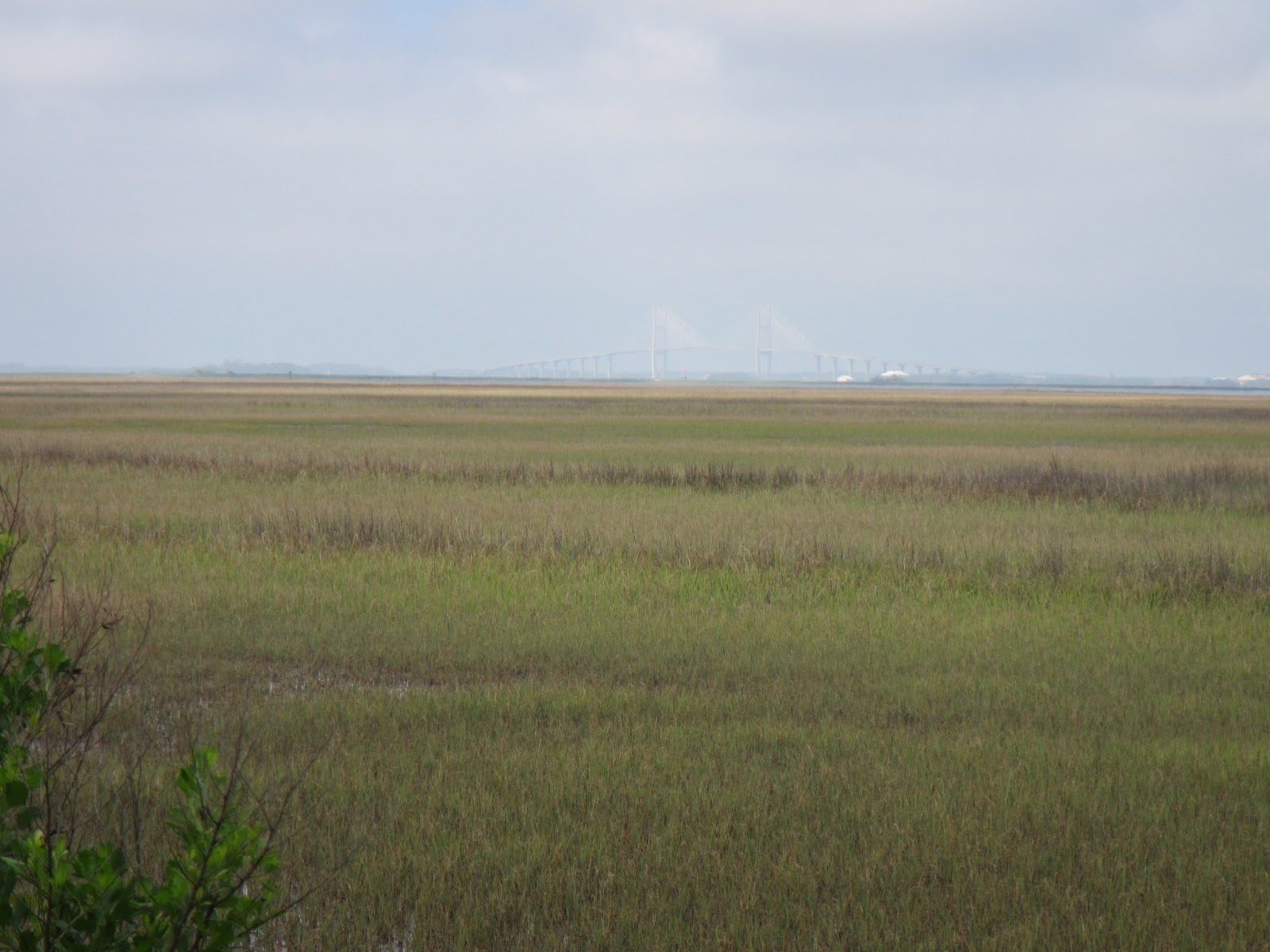
Sidney Lanier Bridge to Brunswick in the background
The fog dissipated quickly this am.  We up anchored with mud stuck to the tip of the anchor; not surprised, in fact relieved, after the blow the night before last.  The sun was warm, the breeze was cool & with it’s strength it was too cool to sit out on the deck.  We followed the circuitous route on a rising tide along the MacKay River at about 6.0K & 8K of wind (with the current) then followed the markers as well as the most helpful ranges towards Buttermilk Sound (against current) at +/- 4.5K & 20K wind on our nose to boot (1115 hrs.).  Big flies like horse flies started invading; the fly swatter was resurrected & was frequently in full swing.  The saltwater marsh grasses had wonderful, new bright green Spring colour to them.  At 1205 hrs. we entered the Little Mud River 1 hour before high tide as planned, therefore with current; 11-14 ft. depths (great) but 18-20K winds & whitecaps (not great).  At 1515 hrs. we passed through Creighton Narrows, a 2nd caution shallow area I dread almost as much as Little Mud River because there are no markers throughout this section; but it was a high falling tide, so good depths except in one spot on the straight before the 2nd last turn northbound where we saw 9.8-10 ft.  The winds were still on our nose heading out towards Sapelo Sound & opposing 1-2 ft. waves, but at least with the tide & current until we turned back towards land at R138, then opposing again.  We decided with wind direction & it’s current strength that we would anchor in the Wahoo River rather than pushing onwards.  We set the anchor around the bend of the Wahoo in 15 ft., but the current was too strong & the boat was being pushed ahead of the anchor; dolphins.  So we reanchored before the bend, away from the crab pots in 15 ft. water & 100 ft. chain, although Graeme did cut the corner & went aground in 4 ft. but powered off the mud.  We were only 2 boats anchored out here.  The winds calmed as the fiery red sun set, a clear sky of orange, then a clear dark sky of stars & ¼ moon.  The peacefulness, the tranquility, the dead total quietness with only salt water marsh grasslands all around is out of this world beautiful & something to experience, yet hard to describe.  And then there is loneliness…
   

Thursday, April 4, 2013

Week 27: Apr. 3-9, 2013 (Day 183-189)


Week 27:

Wed. Apr. 3, 2013—Day 183:
Destination:  Vero Beach (Mile 951.7)
Winds:  SE 10-15K
Weather:  mainly sunny till late afternoon, then threatening rain clouds


Another am that we slept in till 0700 hrs.; high winds were expected late Wed. & Thurs. so we’ve been told, but because we were not moving we were not so concerned.  I haven’t been yelled at recently or spoken to unkindly etc., all kinds of conveniences are here except internet has been suspect for much of the day, free bus service, therefore Vero Beach is not a bad place to lay up.  Graeme took me to shore after breakfast & I had a long 45 min. powerwalk to the beach, along the boardwalk & back to the marina & a lovely shower.  I tried internet but not.  Graeme did an oil & filter change & brought the old oil preserver to the marina office for disposal.  A quick lunch on board then we took the #1 bus to Humiston Park; 3 hrs. of beach time, catching rays, reading , people watching & walking along the expensive shops of Ocean Dr. before taking the 1555 hrs. #1 bus back to the marina.  The clouds were looking very ominous but seemed to have moved off westward.  A quick shower for both of us before dinghying back to the boat.  Terri & Bill’s diesel genset had been leaking a very minimal amount over the last 3 days but unsure exactly where & still there; they were unable to get someone in the near future so have delayed tomorrow’s departure.  We phoned Lynn & Larry over the noon hour & they were on schedule for Lake Worth today, dinner with friends tonight, then Vero tomorrow. 


Thurs.  Apr. 4, 2013—Day 184:
Destination:  Vero Beach (Mile 951.7)
Winds:  S & light & clocking W about 10K to NE to SE about 5-10K
Weather:  cloudy, little rain in the am, tornado warning mid afternoon with lightning & thunder & rain, then cloudy night

Vero Beach Municipal Marina-- lounge, laundry & showers

A warm calm night; thusfar the high winds have not come to flourishen.  It was to shore soon after breakfast with a month’s worth of sorted laundry & supplies, shower supplies & computer backpack supplies + garbage & diesel jerry can.  I did 3 full wash loads @ $2.00 each & 3 dry loads @ $1.50 each; a huge job at the expense or instead of a powerwalk.  It did give me an opportunity to reacquaint with a few cruisers we first met near the beginning of the trip.  A shower felt wonderful as ever & then some emails & my blog, although I was unable to post any pics as the internet was so very slow or cutting in & out.  Graeme took a bus to town for a washer or bolt & hopefully for some info for Larry re a new starter battery, only returning mid afternoon; I was about to take the dinghy & all the laundry, shower & computer back to the boat on my own.  Vero Marina holds a cruisers’ Happy Hour every Thurs. at 1600 hrs. till whenever, but with the pending weather/tornado weather warning we did not attend but awaited the Morrow’s arrival about 1800 hrs.  Instead we hosted a cheering greeting happy hour party with ‘Whiski Mak’ & ‘Second Option’; soon after their arrival & when securely tied up ‘Twomorrows’ joined in.  No lack of conversation & laughs.  A clouded sunset with red sky only visible to the north.  A clouded night, no stars, no moon.

Fri. Apr. 5, 2013—Day 185:
Destination:  Vero Beach (Mile 951.7)
Winds:  SE to S light
Weather:  cloudy & rainy especially in the am, humid to damp till evening

Another quiet & calm night, just humid by morning.  While I showered Graeme took the #1 bus to West Marine yet again.  Towards noon the Morrows & ourselves gathered at the lounge awaiting a pick up by Enterprise Car Rental; Terri & Bill took showers & did laundry & did a run to Publix, then later declined meeting us for Mexican dinner at El Jalisco.  Everyone’s spirits seemed dampened on this grey day.  Our car route included Total Wine, way south in Port St. Lucie, Sam’s Club  & Bells all on US #1, a drive through Ft. Pierce City Marina (construction still in progress by breakwater), then a stop & drink at Harbortown Marina.  We so happened to see Dixie & Rex (Wonderland); hugs & short chat.  We ended the day’s travel with a good dinner at the El Jalisco (Publix Shopping Center).  The humidity had subsided as the north winds increased & in fact it was slightly on the cool side.  We had late evening farewell drinks on our boat as Terri & Bill were leaving in the morning; the umbilical cord was being cut after about 6 wks. of travelling together.  Clouded skies at sunset & all night.

Sat. Apr. 6, 2013—Day 186:
Destination:  Vero Beach (Mile 951.7)
Winds:  brisk, cool WNW to NW +/-15K, decreased by evening
Weather:  mostly a glorious sunny day

Janet & David (Whiski Mak)
Sudden onset of northerly winds of 15-20K during the night causing our 3 boats on one mooring ball to jerk around but all was O.K.  Early morning showers before breakfast & when we returned before 0900 hrs.  Terri & Bill had gone—thanks guys!  It did not seem like a proper farewell.  I thought we could have had a chance to express our thanks & farewell for a great time & friendship of buddy boating; our paths will probably never cross again.  Today’s adventures included Lynn getting a hair cut while I browsed the regular Sat. morning’s Farmers Market at Humiston Park (0800-1200 hrs.) & Larry & Graeme picked up Larry’s new starter battery & finally a trip to Walmart & Publix finishing early afternoon.  Larry drove me to Holy Cross Catholic Church to attend their 1600 hrs. Mass; it was over in 45 mins., something I was not used to while in the Bahamas, so I had time to walk back to the marina.  Janet & David came over & we all enjoyed a very pleasant farewell happy hour; ‘Whiski Mak’ & ourselves plan to depart tomorrow; the Morrows will probably follow suit after turning the car rental in early Mon. am.  The northerly winds decreased & the warmth of the sun was glorious.  There were many conch blowers in the anchorage tonight.  Larry cooked a delicious Hoppin John supper for us which we devoured; hurray, one of the southern dinners on my list!  The icing on the cake was a shot of Nassau Royale.  It remained cloudy during the night as we slowly clocked to the east.

Sun. Apr. 7, 2013—Day 187:
Destination: Vero Beach (Mile 951.7) to Palm Shores (Mile 909)
Departure:  0855 hrs.                          Arrival:  1455 hrs.                                Distance:  42.7 SM
Winds:  NNE 8-12K
Weather:  low level cloud in the am, many sunny periods throughout the day, H= 78F & L= 65F
What ICW number was that?

 A quiet calm night, an early shower, the last garbage disposed of & 1 water jerry can emptied into the boat tank was refilled this morning.  We said our good byes to ‘Cocoon II’ but Bette & Bill (Sea Mist) had not surfaced yet.  The dinghy motor & dinghy were lifted, then breakfast.  We said our good byes to Lynn & Larry who will catch up to us in the next few days.  A parade of a dozen boats (+/-) left this am.  I wondered if we may have an anchorage problem at the end of the day.  Also, I didn’t think we would have any or as much a problem with weekend boat traffic in this central section of Florida, but the powerboats were discourteous, disrespectful, etc. between not announcing their approach from the rear & their speed & wake when passing.  Lots of beautiful homes lined many sections of the ICW waterfront & lots of sea life was seen along the Indian River—dolphins, pelicans, cormorants & osprey & new osprey nests, a sure sign of Spring.  We motorsailed this section knows as the Treasure Coast of Florida under jenny at a speed of +/- 6.0K.  I was able to catch up writing the last 2 days of my blog in Word while moving along.  We had reached Melbourne at 1240 hrs., too early to stop, therefore we continued through 2 more bridges, setting the anchor & 100 ft. of chain in 8 ft. of water at Palm Shores.  There were only 3 boats here for the night, one of which was ‘Whiski Mak’; surprising after the parade of boats heading north today.  We probably should have proceeded to Cocoa because our dilemma now was where to go tomorrow; Titusville is too close & Daytona is too far.  I have mentioned in the past how I would like to see & climb the lighthouse at Ponce de Leon; this might be my opportunity.  A lovely sunset until the sun slid behind the landmass & red sky that followed.  A calm, clear, dark night sky + stars.

Mon. Apr. 8, 2013—Day 188:
Destination:  Palm Shores (Mile 909) to Rockhouse Creek (Mile 842.2)
Departure:  0700 hrs.                         Arrival:  1710 hrs.                               Distance:  66.8 SM
Winds:  N 3-5K & even flat calm, not a ripple at times to NNE at 10K
Weather:  light fog to full sun, few clouds at times then sun again

Fishing standing outside your dinghy
It couldn’t get much calmer last night & the bridge traffic adjacent to where we anchored was light.  We rose before dawn when there was just a sliver moon still visible in the dark sky. Dawn too was just as calm.  The plan was to put some serious miles in today by maintaining a boat speed of 6K & I suggested then Tues. would be a day of exploring Ponce de Leon Inlet & moving a short distance of a couple of hours to Daytona in the afternoon.  Sailing was out of the question in the morning as the winds were much too light & often at times nonexistent & when present was directly on our nose.  We passed through Titusville at about 1230 hrs. & in so doing passed from the Treasure Coast to the Space Coast of Florida.  It was only here that the predicted winds of 10-15mph appeared & not from the east as predicted.  Nevertheless once we passed through Haulover Canal & the bascule bridge into Mosquito Lagoon we were able to use the jenny to our advantage.  And as well the sun was shining once again & nice & warm as I sat half sitting in the cockpit & half on the cockpit combing.  Unfortunately we encountered the same 3 disrespectful, non-communicating motorboat yahoos from Jupiter from yesterday twice today, once before Titusville & once after they had refueled in Titusville.  Vessels were calling ahead warning boats of their belligerent attitude & conduct; these old farts needed to be reported to the authorities.  We got a nice push in the upper or North Indian River as we made our approach closer to New Smyrna Beach (6.8K) + hundreds of small white butterflies flew all around us just like the Spring of 2009 Karen!  There were numerous dolphin sightings & even a manatee   We noticed a possible anchorage across from New Smyrna Yacht Club at about G47- G45.  We took the Sheepshead Cut towards the Coronado Beach Bridge (bascule) in plenty of time for the 1620 hrs. opening.  We attempted to enter the anchorage north of the Coronado Bridge at R22 but gently went aground; we are still not sure how to get into that anchorage.  Yet we had no problems at R18 & it certainly was low tide.  Fortunately, ‘Mutual Fun’ hailed us to say that there was enough room in Rockhouse Creek; we entered between R12 & R10 north of the shoal on the south shore & anchored in 8.5-9 ft. water with 80 ft. chain.  ‘Whiski Mak’ arrived sometime later then came over to discuss plans for the next few days; all in favour of exploring the ocean & beach & climbing the lighthouse at Ponce de Leon Inlet in the morning & early afternoon then proceed the 13 SM to Seabreeze (Daytona) for the night.  Wed. we would push on to St. Augustine & await ‘Twomorrows’ arrival Thurs.  A cool but gorgeous sunset with pink & mauve & red evening sky.  Cool, dark, clear night with stars.

Tues. Apr. 9, 2013—Day 189:
Destination:  Rockhouse Creek (Mile 842.2) to Seabreeze, Daytona (Mile 829.2)
Departure:  1235 hrs.                                 Arrival:  1515 hrs.                              Distance:  13 SM
Winds:  SSE 12-15K, decreased to SE 5-8K evening time
Weather:  brilliant sun, few clouds, 0 humidity, H= upper 70’s & L= upper 60’s
Ponce de Leon Lighthouse

Beach, Surfers, Tents, Vehicles...

A calm night; the tidal current was the major factor affecting boat positions due to the close proximity to Ponce de Leon Inlet.  A bright & most beautiful sunny morning.  All boats but ‘Whiski Mak’ & ourselves left early.  We heard ‘Second Option’ on the VHF & was able to communicate with them; they had a bolt & bracket break on the ammeter on the engine but had repairs done at Halifax Harbor Marina, causing them an extra day in Daytona, but now were off to somewhere north of St. Augustine.  We jumped into our dinghies about 0900 hrs. (high tide at 0822 hrs.) & made our way through the mangrove canal across the waterway to the public dock by the boat launching ramp , then walked to the lighthouse, which does not open till 1000 hrs.  In the meantime we walked toward the inlet, the beach & boardwalk; waves were crashing in, a surfing competition was in progress with vehicles & canvas/nylon tents strung along the beach & surfers in the water, people fishing off the boardwalk & the rock jetty of the inlet passage & walkers.  I could have stayed here all day; I was in my element.  There was a $5.00 admission for the lighthouse (200 steps) & the adjacent museum, but it was now 3 hrs. past high tide & Graeme was worried we would not be able to dinghy back through the mangrove canal  & around the sandbars; very disappointing as there was no time to climb the lighthouse.  We saw locals who had pulled their watercraft up on the sandbars, spread their lounge chairs out & were enjoying this spectacular day of sun & 12-15K SSE wind that was keeping them cool; how cool was this!  We prepared for our departure for the short journey to Daytona, with a 2K current against us, motorsailing up the Halifax River, anchoring north of the Seabreeze Bridge.  Reservations were made for St. Augustine.  There was vivid evidence of low tide around the Ponce de Leon Inlet area with all the exposed sandbars.  An incredible number of dolphins were seen throughout the day & even evening.  Eight boats were anchored here tonight, 2 boats were rafted & 2 other boats were way too close to us, 1 in front & 1 in the rear; sandwiched in by idiots who had no regard for others—great!  I wonder if Graeme or I will sleep tonight & if we will be able to lift anchor early in the am!  An amazing sunset & sky & clear night sky with stars.           

Week 26: Mar. 27- Apr. 2, 2013 (Day 176-182)


Week 26:
                       
Wed. Mar. 27, 2013—Day 176:
Destination:  Manjack Cay to Northwestern Harbour, Great Sale Cay
Departure:  0750 hrs.                         Arrival:                                                      Distance:  58.5 NM
Winds:  NNW 15-20K increasing to 10-15K after sunset +/-15K    
Seas:  1 ft. & whitecaps to < 1 ft. chop
Weather:  mostly cloudy in am, mainly sunny with clouds in

Trying to capture the aqua blue of Bahamas water
The bouncy motion seemed to settle down sometime during the night as the wind shifted slightly more to the north.  It took some time to tune into hear Chris at all; if we heard right Sunday’s window has closed & it is favourable to cross midday Friday & Saturday.  ‘Second Option’ & ourselves decided then to bypass Crab Cay & head directly to Great Sale Cay, a 10 hrs. trek but with long daylight hours in our favour.  We set out & were able to carry a partial jenny for a short time as we motorsailed along (6.5K) until the wind was directly on our nose (5.2K at 3000 RPM).  We passed Crab Cay at 1045 hrs., bore off the wind & deployed a full jenny (6.0K at 2500 RPM).  A fair bit of seagrass was on the water today.  Also, generally speaking, the water was clearer & cleaner in the Exuamas than here in the Abacos.  We passed Fox Town at 1230 hrs. as a family of dolphins played only a short time in our wake; such joy!  About 4-5 boats from Fox Town either travelled to Carters Bank Waypoint or travelled south of Veteran Rock to Sale South Waypoint & finally Great Sale Cay Waypoint.  We were one of the very last to arrive & also one of the furthest out, anchoring in 8 ft. with 100 ft. of chain.  It was a rather easy & comfortable day with plenty of reading, although I did take a turn at the helm.  The clouds filled in late in the afternoon.  And as the sun was setting amongst the clouds it was a big red ball with rays of red light radiating down through the cloud & clear sky, followed by a peachy coloured sky between the cloud patches.  A patchy cloud & clear sky night with stars & the official full moon reflected off the water, which may have been the reason for the lovely firework display tonight.

Thurs. Mar. 28, 2013—Day 177:
Destination:  Great Sale Cay
Winds:  NW-NNW +/- 10K, N 15K at night
Weather:  cool breeze, mainly cloudy with sunny periods in am & mainly sunny in pm

Full Moon rising over Great Sale Cay
Calm water & calm winds during the night; a cool night so had to pull the duvet into service.  Chris confirmed the crossing to Florida best midday Fri. through Sat.  Eight or so boats moved on in the morning & we watched several boats arrive in the mid to late afternoon; a total of 23 tonight  very widely spaced out.  A bit more of intense cleaning of the main cabin.  Otherwise it was a lazy day of suduko, reading in the cockpit until it warmed up, even laying in the sun on deck reading wearing long pants & a long sleeve sweat top.  Graeme topped up the diesel tank in prep for our departure for Little Bahama Bank waypoint tomorrow as soon as Chris’ weather report is completed.  We lowered the dinghy & rowed over to ‘Second Option’ for an early happy hour & a short discussion of the 1st few days when we are State side.  A red sunset with a fair amount of clouds typical of a cool night .  A couple of conch blowers tried their talent or lack of—this was the last time we will here that sound for awhile, maybe forever.  A mainly clear, dark night & thus the most fabulous stars.  A full moon was late rising tonight.

Fri.  Mar. 29, 2013—Day 178:
Destination:  Great Sale Cay to Little Bahama Bank Waypoint 26o 55’N 79o 03’W
Departure:  0730 hrs.                           Arrival:  1615 hrs.                                 Distance:  50.8 NM
Winds:  N to NNE 10-18K                                       Seas:  1-2 ft. waves, 4 ft. NE swells
Weather:  mainly sunny & a bit warmer

Last Bahamian Sunset-- Little Bahama Bank 
Good Friday!   And Happy Anniversary Terri & Bill!  No church & no anniversary celebrations.
The northerly winds picked up after dark to +/- 15K, but by dawn they settled down to +/- 10K.  SSB report at 0630 hrs. reported the weather as still favourable to moving to the Little Bahama Bank waypoint today & on to Ft. Pierce tomorrow; now Sunday was added as a good day as well, so our plans now have a day of grace built into them.  Several boats departed early, some in direction of Memory Rock, some to Little Bahama Bank & others further north ie Cape Canaveral.  There were a few whitecaps on the 1 ft. waves as we got under way under sail with a full jenny at +/- 6.0- 6.5K  on a beam reach & motoring in idle to charge items.  The waves increased to 2 ft. with sustained winds of 15-18K till well after noon, then they slowly decreased to 8-13K & shifted slightly more easterly.  At 1230 hrs. we crossed onto the Little Bahama Bank where the water was a striking clear colour of turquoise.  We were the 3rd boat to anchor at the Little Bahama Bank waypoint (26o 55’N  70o 03’W), anchoring in not so shallow but 19 ft. & 140 ft. chain, with the bank shelf of turquoise water’s edge meeting & dropping to near 75 ft. depths of the cobalt or indigo blue water of the Straits of Florida, just shy of our anchorage.  But like our sail, it was quite rocky & rolly due to the NE swells.  Four of us anchored at this spot but not for long…..
This was the last of aqua to turquoise water, the last of quiet, tranquil & peaceful Bahamian anchorages & lifestyle, the last of some of the friendliest people I have met, both cruisers & locals.  And guess what?  The last Bahamian sunset with patch work clouds only above with a very slight  Bahamian green flash!  Or was it my imagination, or greater yet that desire to see my last Bahamian green flash?

Sat. Mar. 30, 2013—Day 179:
Destination:  Little Bahama Bank to Ft. Pierce, Florida
Departure:  Fri. at 2100 hrs.                      Arrival:  Sat. at 0900 hrs.                      Distance:  63.4 NM
Winds:  E 6-10K, increasing 15-20K                               Seas:  3-1/2 ft. swells, decreasing near dawn
Weather:  mostly clear & stars +++, 7/8 moon light up the night sky, mainly sunny day with cool breeze & clear starry skies

Removing the Bahamian Flag
It was a unanimous decision between the 4 boats that we would not stay here overnight as it was too bouncy, but leave at 2100 hrs. & do an overnight passage.  It wasn’t till after the passage that we learnt that Terri & Bill felt seasick at anchor.  It was too bouncy for Graeme to refuel & he felt it was not necessary, so he tried to sleep, but sleep did not come.  Grilled cheese sandwiches for supper at 2000 hrs., sandwiches & a pot of coffee made for overnight.  We up anchored in the pitch dark under zillions of stars; the 7/8 moon did not rise until 2200 hrs.—a huge orange ball until it was high in the sky.  We all agreed to maintain about +/-6K but 2 of us travelled towards St. Lucie Inlet with expectations that the Gulf Stream would push us north (proved to be the slightly, less ongoing corrective course) & 2 boats motored directly to Ft. Pierce waypoint, adjusting position as necessary along the way.  We were unable to set any sails as the wind was too light & directly behind, whereas those that departed from the Issac Rock area likely had a beam reach sail.  The NNE to NE swells made it a bit bouncy & rolly.  Phosphorescence was seen on the waves off the boat.  We took 2 hour shifts to begin with but Graeme did 0200 hrs. onwards for some reason; I slept in the cockpit till 0400 hrs.  Everyone checked in to the group every hour.  About 10 mi. (0530 hrs.) from shore our GPS lost it’s fix a couple of times.  Our intent was to pass through the inlet at slack tide (0806 hrs.), therefore we were all going too fast & had to slow up.  The American flag was taken down & the ‘Q’ flag took it’s place at dawn before entering port.  Daybreak put a more familiar perspective on the sea.  Ft. Pierce is a nice wide & deep inlet.  Being a weekend & Easter weekend at that, there was a fair number of recreational boat traffic especially fishing boats + local earlybird fishermen.  The dolphins were swimming, eating playing all around us as we passed the entrance to Harbortown Marina & prepared to anchor.   We anchored in the small & shallow anchorage south of the North Bridge (bascule), outside of Harbortown Marina—strong current.  Other options were City Marina or the anchorage by City Marina or Faber Cove.  A good thing we anchored early because in the afternoon there would have been no space; as it was it was too crowded.  I called Mom in Ottawa, we showered, launched the dinghy & tied up to Terri & Bill’s boat as they took a slip in Harbortown Marina.  We were unable to rent a car (none or too expensive), after 3-15 min. attempts unable to get our long digit number from Border & Homeland Security to check into Customs & Immigration & to add to our frustrations we were rudely spoken to on the VHF when making plans for the above.  To my American friends I apologize, BUT welcome to the US!  In the long run we took a taxi to the St. Lucie County Airport-- $13.00 each way.  It was mandatory that we have the long digit number; finally after waiting 25 min. on our cell we were successful & cleared our way into the USA.  A light lunch at the marina restaurant, then we all walked a few blocks to the West Marine & the Publix.  I called Lynn & Larry to find their whereabouts & plans.  A reddish sky after sunset; someone tried to blow a conch but it just wasn’t the same.  A clear starry night with gusting winds.

Last Bahamian Sunrise

Sun. Mar. 31, 2013—Day 180:
Destination:  Ft. Pierce (Mile 964.8)
Winds:  SE calm to gusty 10-15K to S by sunset at 10K
Weather:  mainly sunny but a cool breeze, H= mid 70’s & L= mid 60’s

Happy Easter!  But no proximity to any Church!
Pelican in Flight
A calm, quiet night with some bridge traffic & a nearby train, but slept soundly.  A calm start to the day; the Coast Guard message warned of increasing winds to 20K & rough seas from Jupiter Inlet to the south & Sebastien Inlet to the north; mid morning SE winds gusted up.  It was certainly shallow here in this anchorage; we saw 5’4” to 5’6” at low tide & ‘Second Option’ in their slip in Harbortown Marina were well aground at 3’4”!  For the second time in 2 consecutive days I’ve been rudely told to get off the VHF 71, a pleasure channel & use a cell or landline as today the excuse was that I was interrupting his fishing!  I blew it & told him to quit listening to my conversation or turn his radio off if I was interrupting his fishing & happy Easter!  I knew I needed to reacquaint & readjust to mainland living but this was ridiculous.  If I could I would never come back to Florida!  It’s amazing, we did not have even 1 person that was rude or unpleasant or even unfriendly throughout the Bahamas!  There are always a few that spoil it for the majority!  Graeme added 2 diesel jerry cans & 1-1/2 water jerry cans to the boat tanks; he sprayed clean water on the dodger & enclosure side windows which were heavily laden with salt.  We spoke to a fellow cruiser from the U.K. who had 3 yrs. spent with his wife cruising in the Caribbean, then this winter Puerto Rico & the Bahamas & now the US; because of the US Cruising Permit Laws it is not feasible for him to cruise in the USA X 1 yr. as his cruising permit will expire & he would then have to leave the US for 15 days before renewing the cruising permit, therefore he is forced to sell his boat & not cruise & spend money in the USA.  That applies to us as well but with Graeme being an American citizen the Virginian Border & Homeland Security thusfar has waived that 15 days.  After lunch we dinghied to Terri & Bill’s boat, walked to the West Marine, tried unsuccessfully to walk to the City Marina, charged my computer & checked a few emails, while Terri did laundry & Bill switched to a Bruce anchor & washed his chain locker & deck; at the laundry prices here I will wait till Vero Beach which are expensive enough.  We saw a sea otter swimming through the marina.  Lynn & Larry Morrow had a hell of a sail with 22K winds & 4 ft. seas from Marathon.  We returned to the boat late afternoon & had a nap.  I have not quite adjusted to DST & eating until dark which isn’t till after 2000 hrs.  Sunset was obscured by low level clouds; an orangey pink sky just above the clouds followed & the winds were slowly decreasing.  With all the lights around it was hard to detect how much cloud there was but some stars were visible.

Mon. Apr. 1, 2013—Day 181:
Destination:  Ft. Pierce (Mile 964.8) to Vero Beach (Mile 951.7)
Departure:  1020 hrs.                          Arrival:  1240 hrs.                               Distance: 
Winds:  W 8-18K & gusty
Weather:  cloudy, threatening rain clouds, few sun & blue sky patches & mostly sunny afternoon

A sleepful night & woke to a warm, slightly humid, cloudy morn.  After breakfast Graeme took the 3 empty diesel jerry cans to refill at Harbortown Marina.  We pulled the motor & dinghy on the davits & waited a bit for the tide to come up a bit more.  We went through the Ft. Pierce North Bridge (bascule) with 2 other northbound sailboats & 1 southbound.  A few spits of rain as we motorsailed under ¾ jenny with west winds gusting up & down from 8-18K at an average speed of 5.5-6.8K.  It took a long time for Vero Municipal Marina to answer our hail to receive our mooring ball assignment.  Eventually we were assigned to the empty #2 mooring ball (south anchorage) close to the entrance with ‘Second Option’ as our neighbours.  We learnt that ‘Whiski Mak’ was still here.  Some supper preparations were done for dinner guests, Terri & Bill this evening.  We saw a sea otter by shore & dolphins gracefully swimming amongst the boats.  Late in the afternoon we rode to shore to officially sign in at the marina office, took a lovely long hot shower & read just a few emails.  We discovered that other people we had met earlier in the trip in Staniel Cay were also here.  We had a lovely dinner on a lovely warm night in the cockpit.  Thank you Terri for baking a golden cake with dark chocolate icing—delicious!  A simple delightful evening.  A glorious evening sky, light winds, dark night sky with few stars.

Tues. Apr. 2, 2013—Day 182:
Destination:  Vero Beach (Mile 951.7)
Winds: 
Weather:              

Ibis
It was an early morning rise, to shore for a shower after breakfast & climbed on the 0810 hrs. Go Line #1 bus from the marina to the transfer point, then the #2 bus to Target.  First order of business was a haircut ($15.00)—not great.  We shopped the specials at Bells; Tues. is senior discount day + store specials + new customer discount.  We walked to Walmart for reprovisioning of beer & most food; will purchase fresh fruit & meat closer to departure day.  We took ‘Anywhere Car Service’ (Johnny) who taxied us, Terri & Bill & all our groceries to the marina for a total of $12.00 + tip ($9.00 for 2 persons).  Bill, Graeme & I returned to town by bus to West Marine & ABS Liquor & back.  We organized a gathering of at Riverside Café—‘Second Option’, ‘Whiski Mak’, ‘Cocoon II’, ‘Plan B’ & ourselves.  We all returned to our respective boats before sunset.  No internet today.  The red sun setted behind the land of west Florida.  A clear night sky with stars & calm.